Serra da Barbanza
| Serra da Barbanza | |
|---|---|
| Sierra del Barbanza | |
 | |
| Highest point | |
| Peak | Iroite |
| Elevation | 685 m (2,247 ft) |
| Coordinates | 42°43′35″N 8°55′25″W / 42.726389°N 8.923611°WCoordinates: 42°43′35″N 8°55′25″W / 42.726389°N 8.923611°W |
| Dimensions | |
| Length | 5 km (3.1 mi) N/S |
| Width | 2 km (1.2 mi) E/W |
| Geography | |
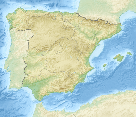 Serra da Barbanza Location in Spain | |
| Location | La Coruña Province, Galicia |
| Country | Spain |
| State/Province | ES |
| Parent range | Galician Massif |
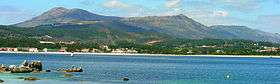
The Serra da Barbanza (Spanish: Sierra del Barbanza) is a mountain range in north-west Spain, extending in a south-westerly direction from Noia in Galicia.
Geography
The range forms the peninsula between the two rias of ría de Muros y Noya and ría de Arosa in the extreme west of Galicia. Due to the relatively large height of over 600 metres (2,000 ft) with respect to the proximity to the two rias it forms an impressive mountain range though small in length.
Highest peaks in the range are Monte Iroite (685 m), Pico Murralla (658 m), Torre de Inxerto (654 m) and Monte Curota (618).
Flora and Fauna
Common vegetation on the mountain range is genista and pines.
Wild horses are common. Other mammals include the Iberian wolf, fox and wild pig.[1]
See also
References
This article is issued from Wikipedia - version of the 3/31/2015. The text is available under the Creative Commons Attribution/Share Alike but additional terms may apply for the media files.