Shadwell, West Yorkshire
| Shadwell | |
 Main Street: Red Lion and Post Office |
|
 Shadwell |
|
| Population | 1,849 (2011) |
|---|---|
| Civil parish | Shadwell |
| Metropolitan borough | City of Leeds |
| Metropolitan county | West Yorkshire |
| Region | Yorkshire and the Humber |
| Country | England |
| Sovereign state | United Kingdom |
| Post town | LEEDS |
| Postcode district | LS17 |
| Dialling code | 0113 |
| Police | West Yorkshire |
| Fire | West Yorkshire |
| Ambulance | Yorkshire |
| EU Parliament | Yorkshire and the Humber |
| UK Parliament | Elmet and Rothwell |
Coordinates: 53°51′17″N 1°29′02″W / 53.8547°N 1.4839°W
Shadwell is a small but affluent village, suburb and civil parish in north east Leeds, West Yorkshire, England. The village is 6 miles (9.7 km) to the north east of Leeds city centre. Shadwell is also close to Wetherby; the local newspaper is the Wetherby News. It has a population of 1,864,[1] reducing to 1,849 at the 2011 Census.[2]
Shadwell borders with Alwoodley, Roundhay, Whinmoor and Moortown from where the main road to the village Shadwell Lane begins. The village is in the LS17 postal code and is served by the Shadwell Parish Council. Shadwell is being increasingly referred to simply as an area or suburb of Leeds but retains its many village traditions.
History
The first written proof of Shadwell's existence is in 1086 in William the Conqueror's Domesday Book, where it is called Scadewelle. Shadwell is thought to be named after the numerous trees that once covered the village with shade and the many wells that were once in use throughout the village. The village pub "The Red Lion" is located between two wells which were originally used to gather water for the brewing process.
Shadwell was historically a township in the ancient parish of Thorner in the West Riding of Yorkshire. Roundhay Grange, originally a grange of Kirkstall Abbey, was a detached part of the township.[3] In 1866 the township became a separate civil parish, but in 1912 the parish was abolished and absorbed into Leeds.[4]
In 1974 Shadwell became part of the enlarged City of Leeds in the new county of West Yorkshire. In 2002 the civil parish was reconstituted, with an elected parish council.[5]
Amenities
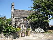
The village has two churches (the Church of England St Paul's, and Shadwell Methodist chapel), a primary school, The Red Lion pub, the Village Hall, a social club, a tennis club, a golf club and six shops (clothing shop, beauty shop, dry cleaner, fish and chip shop, post-office/newsagent and a hairdresser). The library is a Grade II Listed Building. There is also a cricket club. Shadwell United is a junior football club that trains at the primary school. There are thriving Scouts, Cubs, Beavers, Guides and Ranger groups. There is a stone millennium wheel on Main Street, Shadwell.
Slaid Hill
Slaid Hill is an area of Leeds which is within the manor or traditional estate of Shadwell, but is about half a mile west of Shadwell village with clear countryside between them, and the Shadwell name sign between. Slaid Hill is within the Alwoodley Council Ward, whereas Shadwell village is within the Harewood ward.[6]
Today, Shadwell Parish excludes most of Slaid Hill, but includes the estate to the south of Shadwell Lane and east of Roundhay Park Lane.[7] The 1881 Census makes it clear that the district of Shadwell extended to the west end of Shadwell Lane and to the Moortown Ring Road in the South.[8] In addition Shadwell Grange is a large house and farm in Slaid Hill, with a view over the Moortown Ring Road. It is a Grade II listed building.[9]
 Shadwell Village Hall
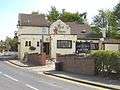 Red Lion
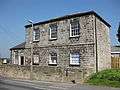 Shadwell Library
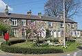 Millennium Wheel and cottages
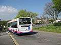 Terminus for the 7S Bus Leeds-Shadwell
 Sign going from Slaid Hill to Shadwell
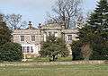 Shadwell Grange viewed from the Leeds Ring Road
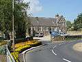
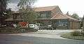 One of the parades of Shops in Slaid Hill
Location grid
 |
Wike | | ||
| Alwoodley | |
Scarcroft | ||
| ||||
| | ||||
| Roundhay |
References
- ↑ Office for National Statistics : Census 2001 : Parish Headcounts : Leeds Retrieved 2009-09-09
- ↑ "Civil Parish population 2011". Neighbourhood Statistics. Office for National statistics. Retrieved 29 February 2016.
- ↑ "Roundhay Park Conservation Area" (PDF). West Yorkshire Archaeological Advisory Service. 2007. Retrieved 6 April 2014.
- ↑ Vision of Britain website
- ↑ Leeds City Council: Shadwell Parish Council
- ↑ Leeds City Council Website accessed 20 April 2009
- ↑ Shadwell Parish Council Website Parish Map
- ↑ Genuki Shadwell Census 1881
- ↑ English Heritage List Entry Shadwell Grange
External links
| Wikimedia Commons has media related to Shadwell, Leeds. |
- The ancient parish of Thorner: historical and genealogical information at GENUKI (Shadwell was in this parish).
- Shadwell Parish Council Website: local parish council website
- Shadwell Village Website: community website
- Shadwell In Bloom: local volunteer group maintaining Shadwell's floral environment
- Shadwell Bridge Club: local Bridge club meeting on Friday evenings
- Shadwell Tennis Club
- Shadwell Cricket Club
- Shadwell Independent Library: taken over from Leeds Council and run by volunteers