Shim'a
| Shim'a שִׁמְעָה / יוֹנָדָב | |
|---|---|
| Hebrew transcription(s) | |
| • official | Yonadav |
|
| |
 Shim'a | |
| Coordinates: 31°23′16″N 35°0′46″E / 31.38778°N 35.01278°ECoordinates: 31°23′16″N 35°0′46″E / 31.38778°N 35.01278°E | |
| District | Judea and Samaria Area |
| Council | Har Hebron |
| Region | West Bank |
| Affiliation | Amana |
| Founded | 1982 |
| Population (2015)[1] | 538 |
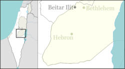
Shim'a (Hebrew: שִׁמְעָה), also Yonadav (Hebrew: יוֹנָדָב), is a non-religious communal Israeli settlement in the southern Judaean Mountains of the West Bank along the Green Line south of Livne and Teneh Omarim. Located on a hill 600 metres above sea level, it falls under the jurisdiction of Har Hebron Regional Council. In 2015 it had a population of 538.
The international community considers Israeli settlements in the West Bank illegal under international law, but the Israeli government disputes this.[2]
History
The settlement was first established in 1982 as a pioneer Nahal military outpost, and demilitarized when turned over to residential purposes in 1988. As of 2015, Shim'a had approximately 600 residents. It is named after King David's brother Shimeah and his son Jonadab (2 Samuel 13:3).
References
- ↑ "List of localities, in Alphabetical order" (PDF). Israel Central Bureau of Statistics. Retrieved 16 October 2016.
- ↑ "The Geneva Convention". BBC News. 10 December 2009. Retrieved 27 November 2010.