Siccar Point
| Siccar Point | |
|---|---|
|
The point seen from the west | |
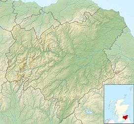 Location in the Scottish Borders | |
| Coordinates | 55°55′54″N 2°18′03″W / 55.9317°N 2.3009°WCoordinates: 55°55′54″N 2°18′03″W / 55.9317°N 2.3009°W |

Siccar Point is a rocky promontory in the county of Berwickshire on the east coast of Scotland. It is famous in the history of geology for Hutton's Unconformity found in 1788, which James Hutton regarded as conclusive proof of his uniformitarian theory of geological development.
History
Siccar Point was the site of a dun, or small hill fort, in the territory of the ancient Britons.
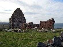
Siccar Point is now in the parish of Cockburnspath but was formerly in the parish of Old Cambus, from which the ancient parish church of St Helen's Chapel survives as a ruin about one kilometre to the west of the point. The church is built in a Romanesque style, in a mixture of Old Red Sandstone believed to have been quarried from the nearby Greenheugh Bay and of the greywacke rock also used in the drystone dyke forming the field boundaries. It is likely that the medieval village of Old Cambus was nearer to Siccar Point than the extant hamlet of Old Cambus.
To the south of the point twentieth-century quarrying for greywacke to be used as roadstone left a hollow named Old Cambus Quarry which is now occupied by a vegetable distribution warehouse complex.[1]
Hutton's Unconformity

Siccar Point is famous in the history of geology as a result of a boat trip in 1788 in which James Hutton, with James Hall and John Playfair, observed the angular unconformity which Hutton regarded as conclusive proof of his uniformitarian theory of geological development. Gently sloping strata of 370-million-year-old Famennian Late Devonian Old Red Sandstone and a basal layer of conglomerate overlie near vertical layers of 435-million-year-old lower Silurian Llandovery Epoch greywacke, with an interval of around 65 million years.[2][3]
See also
References
- ↑ Cliff Ford (2 September 2003). "Siccar Point: Safety". Field Excursion Preview. University of Edinburgh School of GeoSciences. Retrieved 2008-10-20.
- ↑ Lothian and Borders GeoConservation Group (2015). "Hutton's Unconformity, Travel through the "abyss of time"" (pdf). Edinburgh Geological Society. Retrieved 2015-08-31.
- ↑ Browne, Michael; Smith, Richard; Aitken, Andrew M. (2002). "Stratigraphical framework for the Devonian (Old Red Sandstone) rocks of Scotland south of a line from Fort William to Aberdeen" (pdf). Research Report RR/01/004. Keyworth, Nottingham: British Geological Survey, Natural Environment Research Council: 48–50.
External links
| Wikimedia Commons has media related to Siccar Point. |
- James Hutton's account of his visit to Siccar Point in Berwickshire
- John Playfair's historic remarks upon seeing Siccar Point, in vol. V, pt. III, 1805, Transactions of the Royal Society of Edinburgh.
- Research Casting International hung on scaffolding off the cliffs at Siccar Point, painting a large section of the rocks with thick liquid latex (photo) to fabricate an exhibit for the Gottesman Hall of Planet Earth, American Museum of Natural History.
- Map sources for Siccar Point