Sietland
| Sietland | ||
|---|---|---|
| ||
 Sietland | ||
Location of Sietland within Cuxhaven district 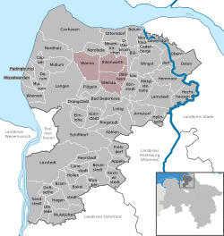 | ||
| Coordinates: 53°44′N 8°55′E / 53.733°N 8.917°ECoordinates: 53°44′N 8°55′E / 53.733°N 8.917°E | ||
| Country | Germany | |
| State | Lower Saxony | |
| District | Cuxhaven | |
| Subdivisions | 4 | |
| Area | ||
| • Total | 143.79 km2 (55.52 sq mi) | |
| Time zone | CET/CEST (UTC+1/+2) | |
| Website | www.sietland.de | |

Sietland is a former Samtgemeinde ("collective municipality") in the district of Cuxhaven, in Lower Saxony, Germany. It was situated in the historical Land of Hadeln approx. 20 km southeast of Cuxhaven. Its seat was in the village Ihlienworth. On 1 January 2011 it merged with the Samtgemeinde Hadeln to form the new Samtgemeinde Land Hadeln.
The Samtgemeinde Sietland consisted of the following municipalities:
References
| Wikimedia Commons has media related to Sietland. |
This article is issued from Wikipedia - version of the 10/14/2016. The text is available under the Creative Commons Attribution/Share Alike but additional terms may apply for the media files.