Siga
|
The mausoleum of Syphax | |
 Shown within Algeria | |
| Location | Algeria |
|---|---|
| Region | Aïn Témouchent Province |
| Coordinates | 35°15′59″N 1°27′00″W / 35.2663°N 1.4499°W |
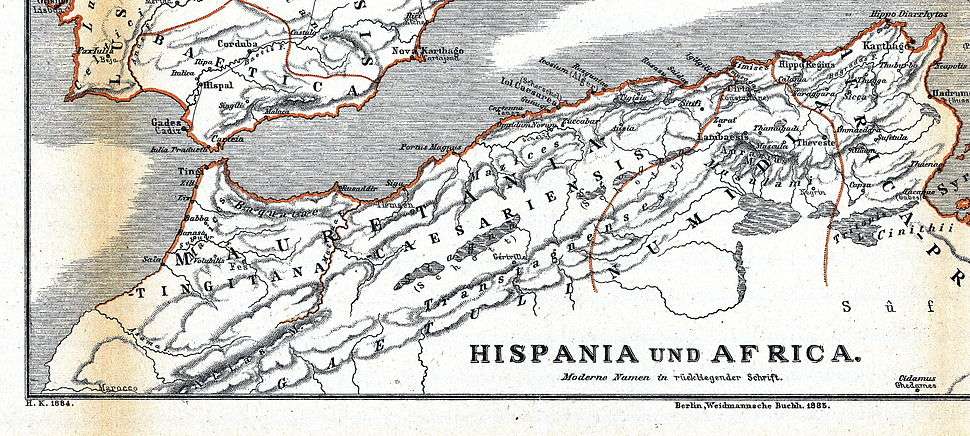
Siga was a Roman port and settlement in western Mauretania Caesariensis, bordering Mauretania Tingitana.
History
Siga was a major port city in the ancient Kingdom of Numidia, located near what is now Aïn Témouchent, Algeria. It was located on Mediterranean coast, at the western border of the territory of the Masaesyli, a Berber tribe. Their traditional opponents were the Berber confederation of the Maesulians, who ruled the eastern portion.
In the course of the Second Punic War, the king of the Masaesyli, Syphax, allied himself with the Roman Republic, and the armies led by Scipio Africanus, while the Maesulians, ruled by Masinissa, sided with the Republic of Carthage. With the defeat and capture of Syphax by Masinissa, the western tribes were conquered and gradually absorbed into a united kingdom under his rule.
Some remains of buildings (of Siga) can be seen on a hill with a flat top in the lower valley of the Tafna at a bend of the river. A milestone found nearby names the site....A part of a necropolis on the plain has produced material of the 1st to 3d c. A.D.Perseus[1]
After a temporary decline, the city got some importance inside the Roman Africa, especially with African emperors Septimius Severus and Caracalla. With the Arab conquest, during the second half of the seventh century, disappeared all references to Siga in documented history.
The current titular see of the Catholic Church of Sigus is probably based on this location (but there was another "Sigus" in western Numidia)[2]
Number of visible or hidden monuments extend on both banks of the river Tafna (called "Siga" in Roman times) including the famous "Numidian mausoleum", the fortified acropolis and some Roman hydraulic and thermal facilities.

See also
Notes
- ↑ Perseus: Siga
- ↑ "Sigus (titular see)". Catholic Hierarchy.
Bibliography
- Bowna, Alan. The Cambridge Ancient History: Volume 12, The Crisis of Empire, AD 193-337. Cambridge university Press. Cambridge, 2005
- Grimal, P. Les fouilles de Siga, "MEFR", 54, 1937, p. 108-141.
- Vuillemot, G. Notes sur un lot d'objets découverts à Siga, "BSGAO" 1953, p. 1-9; Fouille de la nécropole du phare dans I'ile de Rachgoun, Libyca 1955, p. 7-76; Fouilles du Mausolée de Beni-Rhenane en Oranie, "CRAI" 1964, p. 71-95; Siga et son port fluvial, AntAfr 1971, p. 39-86.
Coordinates: 35°15′59″N 1°27′00″W / 35.2663°N 1.4499°W
%2C_Algeria_04966r.jpg)