Sinaqara
| Sinaqara | |
|---|---|
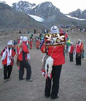 Quyllur Rit'i festival at the foothills of Sinaqara and Qullqipunku | |
| Highest point | |
| Elevation | 5,471 m (17,949 ft) |
| Coordinates | 13°31′42″S 71°14′01″W / 13.52833°S 71.23361°WCoordinates: 13°31′42″S 71°14′01″W / 13.52833°S 71.23361°W [1] |
| Geography | |
 Sinaqara Peru | |
| Location | Peru, Cusco Region |
| Parent range | Andes, Willkanuta mountain range |
| Climbing | |
| First ascent | 1-1979 via S.E. ridge.[2] |
Sinaqara[3] (hispanicized spellings Cinajara, Sinacara, Sinaccara) is a mountain in the Willkanuta mountain range in the Andes of Peru, about 5,471 metres (17,949 ft) high. It is situated in the Cusco Region, Quispicanchi Province, in the districts Ccarhuayo and Ocongate.[4][5] Sinaqara lies southwest of the Qullqipunku. The annual Quyllur Rit'i festival takes place at the foot of the mountains Sinaqara and Qullqipunku.
The river Sinaqara originates near the mountain. It is a tributary of the T'inkimayu.
References
- ↑ ign.gob.pe Nevados, Coordenadas geográficas, IGN, Peru
- ↑ Jill Neate, Mountaineering in the Andes, Peru: "Cinajara 5471m, P.5310m: N. of Ocongate: 1-1979 via S.E. ridge."
- ↑ Diccionario Quechua - Español - Quechua, Academía Mayor de la Lengua Quechua, Gobierno Regional Cusco, Cusco 2005 (Quechua-Spanish dictionary)
- ↑ escale.minedu.gob.pe - UGEL map of the Quispicanchi Province 1 (Cusco Region) showing "Nevado Cinajara"
- ↑ allthemountains.com/httpdocs/ayacachi.htm Map of a part of the Willkanuta mountain range showing "Sinakara" (inactive website)
This article is issued from Wikipedia - version of the 12/7/2015. The text is available under the Creative Commons Attribution/Share Alike but additional terms may apply for the media files.