Skálholt


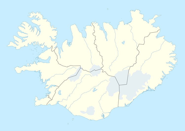
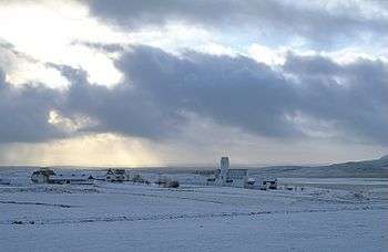
Skálholt (Old Icelandic: Skálaholt) is a historical site in the south of Iceland, at the river Hvítá.
History
Skálholt was, through eight centuries, one of the most important places in Iceland. From 1056 until 1785, it was one of Iceland's two episcopal sees, along with Hólar, making it a cultural and political center. Iceland's first official school, Skálholtsskóli (now Reykjavík Gymnasium, MR), was founded at Skálholt in 1056 to educate clergy. In 1992 the seminary in Skálholt was re-instituted under the old name and now serves as the education and information center of the Church of Iceland.
Throughout the Middle Ages there was significant activity in Skálholt; alongside the bishop's office, the cathedral, and the school, there was extensive farming, a smithy, and, while Catholicism lasted, a monastery. Along with dormitories and quarters for teachers and servants, the town made up a sizable gathering of structures. Adam of Bremen, writing circa 1075, described Skálholt (Scaldholz) as the "largest city" in Iceland. First the diocese of Skálholt was a suffragan of the Archdiocese of Hamburg-Bremen. When in 1104 the Diocese of Lund was elevated to an archdiocese, Lund became the metropolitan of Skálholt, and in 1153 Skálholt became a part of the province of Nidaros.
Continuing as the episcopal see after the Reformation to Lutheranism, the end of Catholicism in Iceland was marked in 1550 when the last Catholic bishop, Jón Arason of Hólar, was executed in Skálholt along with his two sons.
Although no longer episcopal sees, Skálholt and Hólar are still the cathedra of the Church of Iceland's two suffragan bishops, and therefore the old cathedrals still serve as such.
Skálholt also receives many visitors each year. Hospitality is a branch of Skálholtsskóli's work and visitors can stay in its dormitories, single rooms, and cottages. Many cultural events such as concerts are held in Skálholt. Foremost of these is the Summer Concerts program in July, in which prominent classical musicians, choirs and other musicians are invited to perform.
Skálholt Cathedral
The current cathedral at Skálholt is relatively large in comparison to most Icelandic churches; its span from door to apse is approximately 30 meters. Some of its predecessors were even longer, reaching up to 50 m in length. The new cathedral was built from 1956 to 1963 as a part of the millennial celebrations of the episcopal see. The other Scandinavian churches celebrated this along with the Icelandic church and many of the new cathedral's items are gifts of theirs; for example, Gerður Helgadóttir's extensive stained glass windows are a gift from the Danes.
Skálholt Map

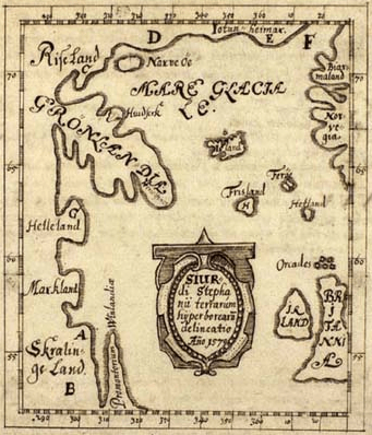
In the late 16th century a young teacher from Skálholt, Sigurd Stefánsson, attempted to use the available documentary evidence to mark the sites of the ancient Norse discoveries in the western Atlantic, including Vinland, on a map. Sigurdur was the grandson of a Skálholt bishop. After studying at the University of Copenhagen, Sigurdur became a teacher at the former monastery of Skálholt, which remained the religious and educational centre in Iceland even after Protestantism was introduced in 1551.[1]
His 1570 original no longer survives. A copy was made in 1690 by Thordur Thorlaksson (also known by his Latinized name, Thorlacius), the Bishop of Skálholt. The map is in the collections of the Danish Royal Library. Numerous other copies were made by Scandinavian scholars. By matching latitudes with the British Isles, the map shows the northern tip of "Vinland" as being at (51°N), the same latitude as the southern tip of Ireland and Bristol, England. This information was transferred to more modern maps. This indicated, among other things, that the promontory of Vinland was marked by Stefánsson at the position of the northern promontory of Newfoundland, which was one of the factors that encouraged the successful archaeological investigations in 1960 at L'Anse Aux Meadows (51°N).[2][3]
See also
References
- ↑ About Stefánsson's map via heritage.nf.ca- accessed 2008-02-05
- ↑ Vikings: The North Atlantic Saga ( Fitzhugh, William W. & Ward, E.I. (eds.) pp20-21. Washington DC: Smithsonian Books. 2000) ISBN 1-56098-995-5
- ↑ Biørn Jonsen of Skarsaa: Description of Greenland and the Skálholt Map (Det Kongelige Bibliotek)
Other sources
- Adam of Bremen (edited by G. Waitz) (1876). Gesta Hammaburgensis ecclesiae pontificum. Berlin. Available online
- Adam of Bremen (translated by Francis Joseph Tschan and Timothy Reuter) (2002). History of the Archbishops of Hamburg-Bremen. Columbia University Press. ISBN 0-231-12575-5
External links
| Wikimedia Commons has media related to Skálholt. |
- Skálholt.is
- Info on Skálholt from Southern Iceland's tourist bureau
- Skálholt Map - in The Royal Library, Copenhagen, Denmark
Coordinates: 64°07′N 20°32′W / 64.117°N 20.533°W