Skarvan and Roltdalen National Park
| Skarvan and Roltdalen National Park | |
|---|---|
|
IUCN category II (national park) | |
|
| |
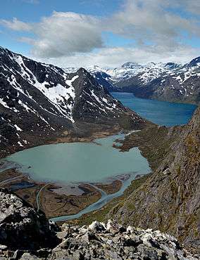
 The Skarvan mountains seen from across the Trondheimsfjord | |
| Location | Sør-Trøndelag and Nord-Trøndelag, Norway |
| Coordinates | 63°13′N 11°25′E / 63.217°N 11.417°ECoordinates: 63°13′N 11°25′E / 63.217°N 11.417°E |
| Area | 441.5 km2 (109,100 acres) |
| Established | 2004 |
| Governing body | Directorate for Nature Management |
Skarvan and Roltdalen National Park (Norwegian: Skarvan og Roltdalen nasjonalpark) lies in Selbu and Tydal municipalities in Sør-Trøndelag county as well as in Meråker and Stjørdal municipalities in Nord-Trøndelag county, Norway.
The park was opened in 2004 and is about 441.5 square kilometres (170.5 sq mi). The park borders on the Stråsjøen-Prestøyan nature reserve and includes a large spruce forested area (the Roltdalen valley is the largest roadless mountain valley in Sør-Trøndelag) as well as the Skarvan mountainous region which is typical of the Trøndelag region, both in cultural and natural history.
The Skarvan mountains, which stretch from Ruten to Fongen is the most notable mountainous area in the region. Trondhjems Turistforening maintains a network of touring trails connecting Roltdalen to the trail network of Nord-Trøndelag Tourist Association and trails in the Sylan area.[1]
Names
The name of the park is a combination of two names. Skarvan is the finite plural of skarv which means "mountain without vegetation". The first element in the name Roltdalen (for Rotldalen, see metathesis) comes from the river name Rotla and the last element is the finite form of dal which means "dale" and "valley". The meaning of the river name is unknown.
References
- ↑ Store norske leksikon. "Skarvan og Roltdalen nasjonalpark" (in Norwegian). Retrieved 2011-02-28.