Skeena-Queen Charlotte Regional District

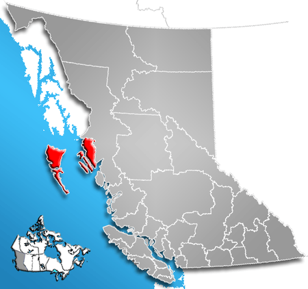
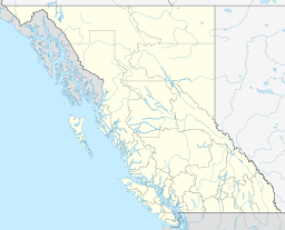
The Skeena-Queen Charlotte Regional District is a quasi-municipal administrative area in British Columbia. It is located on British Columbia's west coast and includes Haida Gwaii (formerly the Queen Charlotte Islands), the largest of which are Graham Island and Moresby Island. Its administrative offices are in the City of Prince Rupert.
Description
- Area: 19,716.14 km²
- Population (2006): 19,664
Electoral areas
- Area A - Skeena North: 29
- Dodge Cove (unincorporated community): 29 (down from 52 in 2011)[1]
- Area C - Skeena South: 147
- Oona River (unincorporated community): 147 (up from 37 in 2011)[2]
- Area D - Haida Gwaii North: 524
- Area E - Haida Gwaii South: 317
Municipalities
- City of Prince Rupert: 12,815
- Village of Queen Charlotte: 948
- Village of Masset: 940
- District of Port Edward: 557
- Village of Port Clements: 440
Indian reserves
In addition to 7,700 aboriginal persons listed in the regional district's community profile at Statistics Canada,[6] there are four separate Indian reserve communities within the regional district whose populations are not included within the regional district's figures, and which are governed separately by their respective band governments. These Indian reserves are:
- Old Massett (Masset Indian Reserve No. 1);
- Skidegate (Skidegate Indian Reserve No. 1);
- Metlakatla; and
- Lax Kw'alaams (Port Simpson Indian Reserve No. 1).
References
- ↑ Census Canada Community Profile, Skeena-Queen Charlotte Electoral Area 'A'
- ↑ Census Canada Community Profile, Skeena-Queen Charlotte Electoral Area 'C'
- ↑ Census Canada Community Profile, Skeena-Queen Charlotte Electoral Area 'D'
- ↑ Census Canada Community Profile, Skeena-Queen Charlotte Electoral Area 'E'
- ↑ "Census Profile: Sandspit, UNP, British Columbia (Designated place)". Statistics Canada. January 8, 2014. Retrieved February 28, 2014.
- ↑ "2001 Community Profiles: Skeena-Queen Charlotte Regional District, British Columbia (Regional District)". Statistics Canada. August 26, 2013. Retrieved February 27, 2014.
External links
Coordinates: 53°44′56″N 132°00′11″W / 53.749°N 132.003°W
