Slavkovský štít
| Slavkovský štít | |
|---|---|
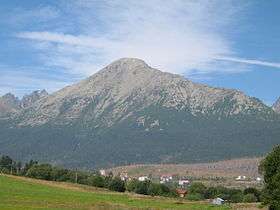 Slavkovský štít viewed from Nová Lesná | |
| Highest point | |
| Elevation | 2,452 m (8,045 ft) |
| Coordinates | 49°10′N 20°11′E / 49.167°N 20.183°ECoordinates: 49°10′N 20°11′E / 49.167°N 20.183°E |
| Geography | |
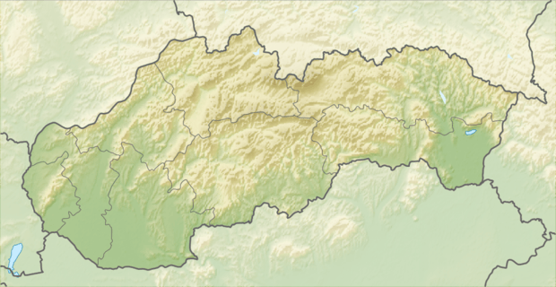 Slavkovský štít Location in Slovakia | |
| Location | Tatra National Park, Poprad, Prešov, Slovakia |
| Parent range | High Tatras |
| Geology | |
| Mountain type | granite |
Slavkovský štít is the fourth highest mountain peak in the High Tatra mountains in Slovakia. Its summit is 2452 metres above sea level. It can be reached by foot on a walking trail in about four and a half hours from Starý Smokovec. The first recorded ascent was by Juraj Buchholtz in 1664.[1]
References
- ↑ Renáta Nározná; Colin Saunders (27 July 2012). The High Tatras: Slovakia and Poland - Including the Western Tatras and White Tatras. Cicerone Press Limited. pp. 185–. ISBN 978-1-84965-486-9.
| Wikimedia Commons has media related to Slavkovský štít. |
This article is issued from Wikipedia - version of the 10/23/2016. The text is available under the Creative Commons Attribution/Share Alike but additional terms may apply for the media files.