Sobat River
| Sobat River | |
| River | |
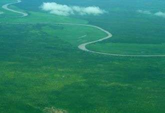 Sobat River from air | |
| Country | South Sudan |
|---|---|
| State | Upper Nile (state) |
| Source | Pibor River and Baro River confluence |
| - coordinates | 8°26′10″N 33°13′7″E / 8.43611°N 33.21861°E |
| Mouth | White Nile |
| - coordinates | 9°22′2″N 31°32′57″E / 9.36722°N 31.54917°ECoordinates: 9°22′2″N 31°32′57″E / 9.36722°N 31.54917°E |
| Length | 354 km (220 mi) [1] |
| Basin | 225,000 km2 (86,873 sq mi) |
| Discharge | for Hillet Doleib |
| - average | 412 m3/s (14,550 cu ft/s) |
| - max | 680 m3/s (24,014 cu ft/s) |
| - min | 99 m3/s (3,496 cu ft/s) |
The Sobat River is a river of the Greater Upper Nile region in northeastern South Sudan, Africa. It is the most southerly of the great eastern tributaries of the White Nile, before the confluence with the Blue Nile.
Geography
The Sobat River is formed by the confluence of the west-flowing Baro River and the north-flowing Pibor River, on the border with Ethiopia. The river enters the White Nile at Doleib Hill, near the city of Malakal in Upper Nile State.
When in flood the Sobat River produces an enormous discharge carrying a white sediment, which gives the White Nile its name.[1](registration required)
Hydrology
The Sobat and its tributaries drain a watershed approximately 225,000 km2 (87,000 sq mi) in size. The river's mean annual discharge is 412 m³/s (14,550 ft³/s).[2]
See also
References
- 1 2 "Sobat River". Encyclopædia Britannica Online Library Edition. Encyclopædia Britannica. Retrieved 2008-01-21.
- ↑ Shahin, Mamdouh (2002). Hydrology and Water Resources of Africa. Springer. pp. 276, 288. ISBN 1-4020-0866-X.; online at Google Books
| Wikimedia Commons has media related to Sobat River. |