Solin
| Solin | ||
|---|---|---|
| City - Grad | ||
| ||
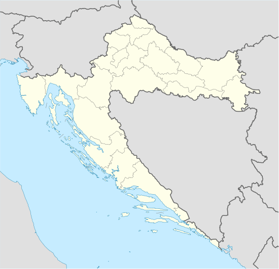 Solin Location of Solin in Croatia | ||
| Coordinates: 43°32′06″N 16°29′06″E / 43.535°N 16.485°E | ||
| Country |
| |
| County |
| |
| Government | ||
| • Mayor | Blaženko Boban (HDZ) | |
| Area | ||
| • Total | 18 km2 (7 sq mi) | |
| Elevation | 0 m (0 ft) | |
| Population (2011)[1] | ||
| • Total | 23,926 | |
| • Density | 1,300/km2 (3,400/sq mi) | |
| • City itself | 20,080 | |
| Postal code | 21 210 | |
| Area code(s) | +385 (0)21 | |
| Vehicle registration | ST | |
| Website | www.solin.hr | |

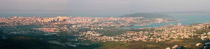
Solin (Latin and Italian: Salona, Ancient Greek: Σαλώνα) is a town in Dalmatia, Croatia. It is situated right northeast of Split, on the Adriatic Sea and the river Jadro.
Solin developed on the location of ancient city of Salona which was the capital of the Roman province of Dalmatia and the birthplace of Emperor Diocletian. After the arrival of Avars and Croats [2] in the 7th-century town was destroyed, and its refugees moved to settlement in and around Diocletian's palace, "Spalatum" (Split), turning it into a fortified town. In the Early Middle Ages Solin was part of the Croatian territory and played an important role in Medieval Croatian state, being one of the political centres.
In the 20th century intensive industrialisation process of the Split basin made Solin no more than a suburb of Split. Today, with its independent municipal status, Solin is part of the Split conurbation, well connected with other towns. Besides industry, a tourism is being developed lately based on numerous archaeological sites and Solin's distinctive image that comes from many urban parks along the Jadro.
Geography
Solin is situated north of the Split peninsula, in a basin surrounded by mountains Kozjak (779 m) to the north and Mosor (1339 m) to the east. The ancient city of Salona developed near the estuary of Jadro, and the later medieval settlement was formed on one of the several islands formed by the river, which is where today's center is also situated.
The city covers an area of 18 km2 (7 sq mi), situated in the central part of the Split conurbation, 8 km (5 mi) north of Split, 6 km (4 mi) east of Kaštela, 22 km (14 mi) east of Trogir and 4 km (2 mi) south of Klis. Residential and business parts of the city are located in the middle part of the river's flow, and on the gentle slopes that make the Solin basin. Industrial areas occupy a small valley of the upper basin of the Jadro, as well as large areas to the west of the center, on the easternmost tip of the bay of Kaštela where industrial and service port is situated. The ruins of the ancient Salona are located in the middle, to the west of today center.
The climate is Mediterranean, with mild winters and hot summers. During the winter, a strong north-eastern wind Bura occurs frequently.
Settlements
The administrative area of the city of Solin includes the following settlements:[1]
- Blaca, population 2
- Kučine, population 974
- Mravince, population 1,628
- Solin, population 20,212
- Vranjic, population 1,110
In the vernacular, Solin is divided into eight neighbourhoods: Centar, Priko vode, Srednja strana, Sveti Kajo, Rupotina, Vranjic, Mravince and Kučine.
History
Ancient Salona
In the late ancient times, Salona's importance was great both politically and religiously. Salona was an early Roman settlement, which became overshadowed when Emperor Diocletian constructed the nearby Diocletian's Palace in about the year 300 AD.[3] Surviving local residents of Salona, after the Avars retreated from those regions, to a settlement "Spalatum", today's (Split), at the location of Diocletian's Palace (probably around the middle 7th century AD). Christianity in Salona probably originated during the time of the apostles. The Apostle Paul mentions that his pupil Apostle Titus traveled to Dalmatia [4] so the assumption that he worked in Dalmatia's capital city of Salona, at least for a short time, is probable. That city, located on the Adriatic coast, with excellent sea connections with Italy and the Middle East, attracted Christian messengers of faith.

Salona had a well-organized Christian community with a bishop as leader ever since the middle of the 3rd century (bishop martyr Venantius lived at that time). Since the fourth century, Salona honored in its large basilicas its glorious martyrs from the times of Diocletian's persecution: St. Domnius (Latin: Domnius; Croatian: Duje; Italian: Domnio), craftsman Anastasius the Fuller, deacon Septimia, priest Asteria and others. In the fifth Century, Salona's bishops started exercising more metropolitan duties (archbishop Hezihius), and in the sixth century they carried the archbishop title as well (arhiepiscopus), and fulfilled the duties associated with the title. (archbishops Stephen, Honorius and others). That means that at that time they held primary positions in western Illyria. Siscia's bishop from the region Pannonia joined the Dalmatian bishops on the synods held in Salona in the years 530 and 533 as a member with full rights. At the time of Diocletian, Salona had a population of 60,000.
In 639 Salona was destroyed by the Croats.[5] After the fall of Salona and the whole region under the Avarian rule (first quarter of 7th century), worship of Salona's martyrs was moved to Rome. Namely, Pope John IV ordered transportation of parts of their relics, which he placed in a dedicated chapel close to the Lateran baptistry. The images of those saints, which had been created in mosaic by the Pope's wish, can be found today in the apside of the chapel.
Search for relics for Rome was probably the incentive for Salona residents who inhabited the new city of Split, located only a few kilometers from the abandoned Salona. At the very least, they wanted to bring to Split the bones of their most important protectors: St. Domnius and St. Anastasius. They placed them in what was once Diocletian's mausoleum, which was subsequently converted into a cathedral.
Middle Ages

In the 9th century, duke Trpimir I of Croatia built a Benedictine monastery between Klis and Solin. Inscriptions dated to 852 from there are first known written record of the name of Croats in modern-day Croatian territory.[6]
In the 10th century, queen Helen (Jelena) had built two churches by the Jadro: the Church of St. Stephen and the Church of St. Mary. The Church of St. Stephen was the burial place of a number of Croatian kings along with other nobility,[7] It was destroyed by the Ottoman Turks in the 16th century. The nearby Church of St. Mary was the burial site of Mihajlo Krešimir II and his wife Jelena, the benefactress.[7]
In the 11th century, the Church of Saint Peter and Moses (known today as "hollow church") was built north of Solin, near the two churches of Saint Mary and Stephen, in which Demetrius Zvonimir was crowned as king of Dalmatia and Croatia.
Transport
Solin is situated on the D8 (E65) Adriatic road ("Jadranska magistrala"), that becomes a 4-lane "Split bypass road" here and continues south towards Split and further down the Adriatic coast. A big roundabout south of the city centre is a major intersection with a D1 (E59) road that connects the area of Split conurbation with the A1 Zagreb-Split highway.
Zagreb - Split railway passes through the city territory. Although there is a train station in Solin (2 km (1 mi) to the west of the city centre), only regional trains stop here. Regional rail transport is to be intensified because of the Split Suburban Railway project.
Split Airport (SPU) in Kaštela is situated 15 km (9 mi) to the west of Solin, well connected by roads and local transport.
Public transport is organized by several bus lines operated by Promet Split company that provides public transport for the Split conurbation. These routes are:
- #1 Starine (Solin) - HNK (Split)
- #2 Kaštel Sućurac - Trajektna luka (Split)
- #5 Dračevac (Solin) - HNK (Split)
- #10 Japirko (Solin) - Trajektna luka (Split)
- #13 Kolodvor Sukoišanska (Split) - Dračevac (Solin)
- #16 Ninčevići (Solin) - HNK (Split)
- #22 Rupotina (Solin) - HNK (Split)
- #32 Kolodvor Sukoišanska (Split) - Kučine (Solin)
Local bus lines from Split to Kaštela, Trogir, Klis and Sinj also stop in Solin centre.
Climate
Climate in this area has mild differences between highs and lows, and there is adequate rainfall year round. The Köppen Climate Classification subtype for this climate is "Csa" (Mediterranean climate).
| Climate data for Solin, Croatia | |||||||||||||
|---|---|---|---|---|---|---|---|---|---|---|---|---|---|
| Month | Jan | Feb | Mar | Apr | May | Jun | Jul | Aug | Sep | Oct | Nov | Dec | Year |
| Record high °C (°F) | 17.4 (63.3) |
22.3 (72.1) |
23.2 (73.8) |
27.7 (81.9) |
33.2 (91.8) |
38.1 (100.6) |
38.6 (101.5) |
38.1 (100.6) |
34.2 (93.6) |
27.9 (82.2) |
25.8 (78.4) |
18.1 (64.6) |
38.6 (101.5) |
| Average high °C (°F) | 10.3 (50.5) |
11.0 (51.8) |
13.7 (56.7) |
17.4 (63.3) |
22.5 (72.5) |
26.7 (80.1) |
29.8 (85.6) |
29.5 (85.1) |
25.1 (77.2) |
20.0 (68) |
14.9 (58.8) |
11.5 (52.7) |
19.37 (66.86) |
| Daily mean °C (°F) | 7.9 (46.2) |
8.3 (46.9) |
10.6 (51.1) |
14.2 (57.6) |
19.1 (66.4) |
23.0 (73.4) |
25.9 (78.6) |
25.5 (77.9) |
21.4 (70.5) |
17.0 (62.6) |
12.5 (54.5) |
9.2 (48.6) |
16.22 (61.19) |
| Average low °C (°F) | 5.4 (41.7) |
5.5 (41.9) |
7.6 (45.7) |
10.8 (51.4) |
15.2 (59.4) |
18.8 (65.8) |
21.6 (70.9) |
21.5 (70.7) |
18.1 (64.6) |
14.1 (57.4) |
9.9 (49.8) |
6.0 (42.8) |
12.88 (55.17) |
| Record low °C (°F) | −9.0 (15.8) |
−8.1 (17.4) |
−6.6 (20.1) |
0.3 (32.5) |
4.8 (40.6) |
9.1 (48.4) |
13.0 (55.4) |
11.2 (52.2) |
8.8 (47.8) |
3.8 (38.8) |
−4.5 (23.9) |
−6.3 (20.7) |
−9.0 (15.8) |
| Average precipitation mm (inches) | 77.3 (3.043) |
62.8 (2.472) |
63.4 (2.496) |
62.6 (2.465) |
55.4 (2.181) |
49.7 (1.957) |
26.3 (1.035) |
42.7 (1.681) |
71.0 (2.795) |
76.5 (3.012) |
112.9 (4.445) |
103.5 (4.075) |
804.1 (31.657) |
| Average rainy days | 11 | 10 | 10 | 9 | 9 | 9 | 6 | 5 | 7 | 9 | 12 | 12 | 109 |
| Average snowy days | 1 | 2 | 0 | 0 | 0 | 0 | 0 | 0 | 0 | 0 | 0 | 1 | 4 |
| Mean monthly sunshine hours | 131.5 | 147.9 | 186.8 | 217.2 | 273.0 | 307.4 | 350.3 | 324.8 | 247.3 | 196.9 | 130.6 | 119.3 | 2,633 |
| Source #1: National Meteorological and Hydrological Service (Croatia) [8] | |||||||||||||
| Source #2: World Weather Information Service [9] | |||||||||||||
References
- 1 2 "Population by Age and Sex, by Settlements, 2011 Census: Solin". Census of Population, Households and Dwellings 2011. Zagreb: Croatian Bureau of Statistics. December 2012.
- ↑ A History of the Croatian by Francis Ralph Preveden,1955
- ↑ C. Michael Hogan, "Diocletian's Palace", the Megalithic Portal, A. Burnham ed., Oct. 6, 2007
- ↑ The Holy Bible: 2 Timothy 4, 10)
- ↑ Spalato-Macarsca (Salona), Catholic Encyclopedia
- ↑ "Rižinice" (in Croatian). City of Solin. Retrieved 2011-11-28.
- 1 2 "Gospin otok" (in Croatian). City of Solin. Retrieved 2011-11-28.
- ↑ "Monthly Climate Values". Croatian Meteorological and Hydrological Service. Retrieved 13 July 2013.
- ↑ "Climatological Information". World Meteorological Organization. Retrieved 13 July 2013.
External links
- Solin official website
- Tourist board of Solin, with tourist info in English
- Salona
- The archaeological complex of Salona (part of the Archaeological museum of Split)
- Solin on Google Maps
Subdivisions of Split-Dalmatia County | ||
|---|---|---|
| Cities and towns |  | |
| Municipalities |
| |