Somerville Junction
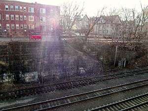
Somerville Junction was the name of a railroad junction and station in Somerville, Massachusetts, United States. The station, which closed in 1927,[1] was located at the site of the present-day park near the intersection of Centre and Woodbine Streets.[2][3] Nearby, a westward connector split off from the main line of the Boston and Lowell Railroad. It was built by the B&L to connect to the Lexington and Arlington Railroad after its 1870 acquisition. A branch was later added, extending the connector to form the Fitchburg Cutoff. A publication highlighting Somerville railroad history in connection with the MBTA Green Line extension project includes a photo of the depot and a discussion of Somerville Junction's history.[1] Per 1895 maps, the station was situated about 70 yards (65 meters) from the Central Street bridge,[4] and the junction of the tracks was about 240 yards (225 meters) farther northwest.[5]
The station was still in use in 1945, although the station building was abandoned in the 1930s.[1][6] It was closed completely prior to the 1958 cuts that closed North Somerville, Tufts College, and Medford Hillside stations.[7]
References and notes
- 1 2 3 "Rails of the Past" (2008), pp. 3-4 Accessed March 31, 2012
- ↑ The Park at Somerville Junction, at the site of the former station, was dedicated on September 25, 2008. Centre St. is not to be confused with Central St.
- ↑ "Parks and Open Space - Park at Somerville Junction". Retrieved 2015-08-16.
- ↑ 1895 map showing station location Accessed April 9, 2012
- ↑ 1895 map showing junction Accessed April 9, 2012
- ↑ "Proposed Rapid Transit Route: Lechmere to Woburn". Report of the Legislative Commission on Rapid Transit. 1945. Archived from the original on 22 February 2014 – via Somerville Transportation Equity Partnership.
- ↑ "Drastic Service Cuts Approved on Five B.& M. Divisions". Daily Boston Globe. 19 April 1958. p. 11 – via Proquest Historical Newspaper. (subscription required (help)).
Coordinates: 42°23′26.2″N 71°06′10.1″W / 42.390611°N 71.102806°W