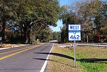
South Carolina Highway 462
| ||||
|---|---|---|---|---|
| Route information | ||||
| Maintained by SCDOT | ||||
| Length: | 35.7 mi[1] (57.5 km) | |||
| Existed: | 1942 – present | |||
| Major junctions | ||||
| West end: |
| |||
|
| ||||
| East end: |
| |||
| Location | ||||
| Counties: | Jasper, Beaufort | |||
| Highway system | ||||
| ||||

South Carolina Highway 462 (SC 462) is a primary state highway in the U.S. state of South Carolina. It serves as a circuitous routing through northern and eastern Jasper County.
Route description
SC 462 is a rural two-lane highway that makes a half-circle in Jasper County, broken into four named sections of road. The first section named "Gillison Branch Road" begins at the intersection of US 321, in Robertville, and goes northeast to US 601, in Pineland, then east connecting with US 278, in Gillisonville. The second section named "Morgandollar Road," connects Gillisonville with Coosawhatchie. The third section named "Coosaw Scenic Drive" connects Coosawhatchie with SC 336, in Old House. The fourth section named "Lowcountry Drive" continues on from SC 336 to its eastern terminus at SC 170, in Beaufort County.
The highway connects to several historic places, including Robertville Baptist Church, Gillisonville Baptist Church and the Old House Plantation. However, it is not scenic as it is predominantly forest or swampland.
History
Established in 1941 or 1942 as a new primary routing from SC 170 to SC 46, in Bluffton, existing entirely in Beaufort County.[2] In 1956, SC 462 ceded some of its routing to SC 46 (Bluffton Road).[3] In 1958, SC 462 was extended north to Coosawhatchie and then west to SC 128, in Gillisonville, replacing SC 170.[4] Between 1962-1964, SC 462 was extended west again over existing secondary roads to its current western terminus at Robertville; this brought the highway's maximum length to 46 miles (74 km).
Between 1965-1967, SC 462 east was truncated to US 278, in Old House, it's old alignment south to near Bluffton becoming part of US 278.[5] By 1998, SC 462 was extended south after US 278 realignment to near Hardeeville, reclaiming some of its old routing to SC 170.[6]
Junction list
| County | Location | mi[1] | km | Destinations | Notes |
|---|---|---|---|---|---|
| Jasper | Robertville | 0.0 | 0.0 | ||
| Pineland | 2.5 | 4.0 | |||
| Gillisonville | 12.7 | 20.4 | West end of US 278 overlap | ||
| | 13.5 | 21.7 | East end of US 278 overlap | ||
| | 18.3 | 29.5 | I-95 exit 28. | ||
| Old House | 27.8 | 44.7 | |||
| Beaufort | | 35.7 | 57.5 | ||
1.000 mi = 1.609 km; 1.000 km = 0.621 mi
| |||||
References
- 1 2 Google (November 17, 2013). "South Carolina Highway 462" (Map). Google Maps. Google. Retrieved November 17, 2013.
- ↑ General Highway Map, Beaufort County, South Carolina (PDF) (Map). Cartography by SCDOT. South Carolina Department of Transportation. 1943. Retrieved November 17, 2013.
- ↑ General Highway Map, Beaufort County, South Carolina (PDF) (Map). Cartography by SCDOT. South Carolina Department of Transportation. 1957. Retrieved November 17, 2013.
- ↑ General Highway Map, Jasper County, South Carolina (PDF) (Map). Cartography by SCDOT. South Carolina Department of Transportation. 1959. Retrieved November 16, 2013.
- ↑ General Highway Map, Beaufort County, South Carolina (PDF) (Map). Cartography by SCDOT. South Carolina Department of Transportation. 1966. Retrieved November 17, 2013.
- ↑ General Highway System - Jasper County (PDF) (Map). South Carolina Department of Transportation. June 2005. Retrieved November 17, 2013.
External links
-
 Media related to South Carolina Highway 462 at Wikimedia Commons
 - Mapmikey's South Carolina Highways Page: SC 460-499