St Osyth
| St Osyth | |
 Village Sign |
|
 St Osyth |
|
| Population | 4,277 (2011)[1] |
|---|---|
| OS grid reference | TM123156 |
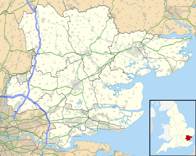
| District | Tendring |
| Shire county | Essex |
| Region | East |
| Country | England |
| Sovereign state | United Kingdom |
| Post town | CLACTON-ON-SEA |
| Postcode district | CO16 |
| Dialling code | 01255 |
| Police | Essex |
| Fire | Essex |
| Ambulance | East of England |
| EU Parliament | East of England |
| UK Parliament | Clacton |
Coordinates: 51°47′56″N 1°04′48″E / 51.799°N 1.080°E
St Osyth is a village and civil parish in northeast Essex. It is about 5 miles (8.0 km) west of Clacton-on-Sea, and about 12 miles (19.3 km) southeast of Colchester. It is located on the B1027 road and is named after Osyth, a 7th century saint and princess. The name is locally pronounced "Toosey".
St Osyth is claimed to be the driest recorded place in the United Kingdom.
History
Before being renamed to commemorate Saint Osyth, the village was called Chich (also Chiche or Chick), from an Old English word meaning "bend",[2] in reference to St Osyth Creek.
St Osyth was the subject of an episode of Channel 4's Time Team programme, "Lost Centuries of St Osyth", (series 12 episode 9, first broadcast in February 2005). This programme sought to uncover the early origins of the village, which was presumed to have grown up at around the same time as the Priory, in the twelfth century. Many of the investigations around the current village centre found little evidence of settlement earlier than the fourteenth century; it appeared that the early village centre lay some way off, between the Priory and the river.
The village was a focus for the St Osyth witch persecutions in the sixteenth and seventeenth centuries with a total of ten local women being hanged as a result. In 1921 the skeletons of two women were discovered in the garden of a house in the village. One was claimed to be the witch Ursley Kempe who was the first to be prosecuted. The skeletons became a local tourist attraction.[3]
In 2012, alleged sightings of a lion near the village sparked an armed hunt for the animal. The search was ended within 24 hours after no trace of the animal was found, nor had any animals escaped from a nearby circus or Colchester Zoo.[4]
Legend of Saint Osyth
Legend has it that Saint Osyth (or Ositha) was a young lady who was involved in various fantastical events during her lifetime. Tales include:
- A young Osyth drowned in a stream, but was revived by nuns from the local convent praying for her for three days.
- Osyth was executed by beheading; where she fell a spring issued forth from the ground. She picked up her head and walked to the door of the nunnery where she knocked three times on the door before collapsing.
- Osyth's ghost walks along the priory walls carrying her head one night each year.
Geography

St Osyth is claimed to be the driest recorded place in the United Kingdom with an average rainfall of just 513 mm per year.[6] Although a significant part of the parish boundary is coast which does not need to be "beaten", St Osyth is one parish which maintains the tradition of beating the bounds on Rogation days.[7]
Point Clear
Point Clear is a separate village within the parish, located at grid reference TM091151 southwest of St Osyth and on the other side of St Osyth Creek, a branch of the Colne Estuary. It first appears on a map in 1880.[8]
Landmarks

The most notable building in the village is undoubtedly St Osyth's Priory,[10] a group of Grade I listed buildings.[9][11][12][13][14]
The Abbey was the home to the Earls of Rochford, following William Third's creation of the title, given to William Nassau de Zuylestein in 1695.
St Osyth's Priory was once the home of a herd of polled White Park cattle, until an outbreak of Foot and Mouth disease in 1951 which led to their slaughter. A contemporary account states:
At St Osyth Priory, where an outbreak occurred last week, there was one of the few remaining herds of white Park cattle, one of the oldest breeds in this country. That has now been slaughtered, together with the small dairy herd and the stock of pigs. The farm is attached to the convalescent home maintained at the Priory by the Shepherds Friendly Society.[15]
The land within the Priory boundaries is shown as a Deer Park on the Ordnance Survey map.[16]
The village church is dedicated to Saints Peter and Paul.[17]
The Martello tower at Point Clear has been converted into a war museum.[18]
Another landmark is Mill Dam Lake. This lake is filled and emptied from St Osyth Creek. The lake is used for water skiing.
St Osyth Beach
The neighbouring settlement of St Osyth Beach contains Essex's largest concentration of static caravan parks, including Seawick, St Osyth Beach (owned by Park Holidays UK) & Hutleys. The holiday parks boost the local population in the summer months by an estimated 7,000 people. Part of the beach is usd by naturists for nude bathing.[19][lower-alpha 1]
St Osyth Beach and adjoining Jaywick were the scene of fatalities during "The Great Flood" of 1953.
Entertainment
The Venue is an entertainment venue that opened in St Osyth in early 2009. In its opening year it played host to the Sugababes, N-Dubz, The Drifters, Ricky Tomlinson, Kevin Bloody Wilson and The Stylistics.
The St Osyth Social Club in Church Square is home to league darts teams, St Osyth Social, The Priorymen and SOSC Ladies.
Notable people
- Benjamin Golding (1793–1863), founder of Charing Cross Hospital
- William Nassau de Zuylestein, 1st Earl of Rochford (1649–1708), an Anglo-Dutch soldier and diplomat
- William Nassau de Zuylestein, 4th Earl of Rochford (1717–1781), a diplomat and statesman
- Somerset de Chair (1911–1995), an author and politician
Notes and references
- ↑ The naturist beach is located at 51°46′13″N 1°04′04″E / 51.770330°N 1.067659°E, access to the beach is from 51°46′21″N 1°05′14″E / 51.772527°N 1.087310°E[20]
- ↑ "Ward/Civil Parish population 2011". Retrieved 25 September 2015.
- ↑ Hanks, Patrick; Hodges, Flavia; Mills, David; Room, Adrian (2002). The Oxford Names Companion. Oxford: the University Press. p. 1179. ISBN 0198605617.
- ↑ Rowlands, Alison. "BONES OF CONTENTION". Centre for Local and Regional History. University of Essex. Retrieved 6 May 2009.
- ↑ BBC (27 August 2012). "Essex Police investigate 'lion' sighting near St Osyth".
- ↑ "Earls Hall Farm windfarm (United-Kingdom)". The Wind Power. October 2013. Retrieved 13 October 2013.
- ↑ Dwan, James (4 January 2007). "St Osyth: Village is driest place in the UK". Colchester: Daily Gazette. Retrieved 30 June 2013.
- ↑ Parish Council website
- ↑ a map in 1880
- 1 2 Historic England. "St Osyth's Priory, Gatehouse and east and west flanking ranges (Grade I) (1111495)". National Heritage List for England.
- ↑ Henry Thorold, The Ruined Abbeys of England, Wales and Scotland, Collins, 1993
- ↑ Historic England. "St Osyth's Priory the Darcy Tower also known as Abbot's Tower and vaulting to west (Grade I) (1146545)". National Heritage List for England.
- ↑ Historic England. "St Osyth's Priory the Chapel of St Osyth and ruins attached to north (Grade I) (1166377)". National Heritage List for England.
- ↑ Historic England. "St Osyth's Priory: The Abbot's Lodging and South Wing, the Darcy Clock Tower and C18 House (formerly listed as the Convalescent Home) (Grade I) (1337158)". National Heritage List for England.
- ↑ Historic England. "St Osyth's Priory ruined east ranges of the Darcy House including the Tower and Chapel (Grade I) (1337159)". National Heritage List for England.
- ↑ Essex Farming – 1900–2000 by Peter Wormell, published by Abberton Books
- ↑ Joyce, Terry (2008). "TM1216 : Deer Park, St Osyth". Geograph Britain and Ireland. Retrieved 2016-05-30.
- ↑ Historic England. "Church of St Peter and St Paul (Grade I) (1111513)". National Heritage List for England.
- ↑ Historic England. "Martello Tower (Grade II) (1309070)". National Heritage List for England.
- ↑ Rutherford, Tristan (15 June 2015). "Britain's best nudist or naturist beaches". Telegraph.co.uk. Retrieved 16 August 2015.
- ↑ "St Osyth Naturist Beach". naturistdirectory.com. Retrieved 2016-05-30.
External links
| Wikimedia Commons has media related to St Osyth. |