Stadtlauringen
| Stadtlauringen | ||
|---|---|---|
| ||
 Stadtlauringen | ||
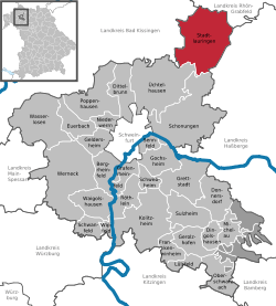
Location of Stadtlauringen within Schweinfurt district  | ||
| Coordinates: 50°11′17″N 10°21′34″E / 50.18806°N 10.35944°ECoordinates: 50°11′17″N 10°21′34″E / 50.18806°N 10.35944°E | ||
| Country | Germany | |
| State | Bavaria | |
| Admin. region | Unterfranken | |
| District | Schweinfurt | |
| Government | ||
| • Mayor | Friedel Heckenlauer (CSU) | |
| Area | ||
| • Total | 63.62 km2 (24.56 sq mi) | |
| Population (2015-12-31)[1] | ||
| • Total | 4,055 | |
| • Density | 64/km2 (170/sq mi) | |
| Time zone | CET/CEST (UTC+1/+2) | |
| Postal codes | 97488 | |
| Dialling codes | 09724 | |
| Vehicle registration | SW | |
| Website | www.stadtlauringen.de | |
Stadtlauringen is a municipality in the district of Schweinfurt in Bavaria, Germany.
Geography
Location
Stadtlauringen is in the Main Rhön region, circa 20 kilometers north east of Schweinfurt. It is the northern-most municipality in the district of Schweinfurt. The Lauer flows through it. The Ellertshäuser See is close to the village Altenmünster.
Towns and Villages
The municipality Stadtlauringen consists of the following towns and villages:
- Altenmünster with Ellertshausen and Reinhardshausen
- Ballingshausen
- Birnfeld
- Fuchsstadt
- Mailes
- Oberlauringen
- Stadtlauringen
- Sulzdorf
- Wettringen
- Wetzhausen
History
In 794 A.D. it was first documented as Lauringen, then later as Niederlauringen. In 1484 it received municipality and city rights, and was also renamed to Stadtlauringen. In 1818 city rights were abandoned, but municipality rights were kept.
The coat of arms originates from the time when city rights were acquired.
Mayor
Mayor is Friedel Heckenlauer (CSU).
Sources
- Reinhold W. F. Heusinger: Markt Stadtlauringen. Beiträge zur Heimatgeschichte. Markt Stadtlauringen, Stadtlauringen 1994. (German)
References
- ↑ "Fortschreibung des Bevölkerungsstandes". Bayerisches Landesamt für Statistik und Datenverarbeitung (in German). June 2016.
