Stanground North
Coordinates: 52°33′07″N 0°12′47″E / 52.552°N 0.213°E
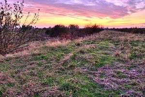
Stanground North was a civil parish in the City of Peterborough, England. The 2001 census recorded a population of zero. The parish, which covered open fields on a flood plain of the River Ouse, has since been abolished as redundant.[1]
The parish was originally created in 1905, when Stanground parish was divided into two (Stanground South becoming part of Old Fletton urban district), having hitherto been the only parish to still cross a county border.[2]
From then until 1974, it formed the only parish in Thorney Rural District apart from Thorney, Cambridgeshire, being in Isle of Ely until 1965 and then Huntingdon and Peterborough. In 1974 it became part of the Peterborough district of Cambridgeshire.
It had a peak population of 43 in the census of 1921.[3]
References
- ↑ "Parish Review" (PDF). Peterborough City Council. 16 April 2003. Archived from the original (PDF) on 26 September 2007.
- ↑ 'Modern' Administrative Areas, Vision of Britain
- ↑ Stanground North - Population