Stavanger Peninsula
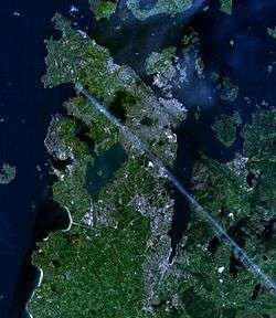
Stavanger Peninsula (Norwegian: Stavangerhalvøya) is a peninsula in Rogaland county, Norway. The peninsula is named for the city of Stavanger, located on its northeastern shore and it includes the most populous parts of Greater Stavanger. The peninsula extends from a line between the Sandnes harbour at the southern end of the Gandsfjorden straight west to the village of Ølbør in Sola. This line runs just south of Stavanger Airport. The peninsula is delimited by the Gandsfjorden, Boknafjorden, Byfjorden, and the North Sea.
Stavanger Peninsula comprises mainland Stavanger and Randaberg municipalities, as well as parts of Sandnes and Sola municipalities.[1]
The name Stavanger Peninsula can sometimes be used interchangeably with North Jæren (Norwegian: Nord-Jæren), but the former is a geographical region, while the latter is a political definition.
References
- ↑ "Nei til strømkabel i Lysefjorden" (in Norwegian). aftenbladet.no. 2012-08-22. Retrieved 2013-01-30.
Coordinates: 58°56′N 5°42′E / 58.933°N 5.700°E