Stibbard
| Stibbard | |
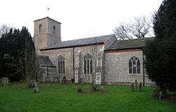 All Saint's Parish Church, Stibbard |
|
 Stibbard |
|
| Area | 7.30 km2 (2.82 sq mi) |
|---|---|
| Population | 346 (parish, 2011 census) |
| – density | 47/km2 (120/sq mi) |
| OS grid reference | TF981282 |
| – London | 120 miles (190 km) |
| Civil parish | Stibbard |
| District | North Norfolk |
| Shire county | Norfolk |
| Region | East |
| Country | England |
| Sovereign state | United Kingdom |
| Post town | FAKENHAM |
| Postcode district | NR21 |
| Dialling code | 01328 |
| Police | Norfolk |
| Fire | Norfolk |
| Ambulance | East of England |
| EU Parliament | East of England |
| UK Parliament | Broadland |
Coordinates: 52°49′N 0°56′E / 52.81°N 0.93°E
Stibbard is a village[1] and civil parish in the English county of Norfolk. The village is 19.3 miles (31.1 km) south-west of Cromer, 21.2 miles (34.1 km) north-west of Norwich and 120 mi (190 km) north-east of London. The village lies 4.9 miles (7.9 km) south-east of the nearby town of Fakenham. The nearest railway station is at Sheringham for the Bittern Line which runs between Sheringham, Cromer and Norwich. The nearest airport is Norwich International Airport.
It covers an area of 7.30 km2 (2.82 sq mi) and had a population of 365 in 149 households at the 2001 census,[2] the population falling to 346 at the 2011 Census.[3] For the purposes of local government, it falls within the district of North Norfolk.
References
- ↑ OS Explorer Map 24 Norfolk Coast Central. ISBN 0-319-21726-4
- ↑ Census population and household counts for unparished urban areas and all parishes. Office for National Statistics & Norfolk County Council (2001). Retrieved 20 June 2009.
- ↑ "Parish population 2011". Retrieved 4 September 2015.
External links
| Wikimedia Commons has media related to Stibbard. |