Summerlin, Nevada
| Summerlin | |
|---|---|
| Master-planned community | |
| Neighborhood of Las Vegas, Nevada | |
|
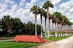
Summerlin Entrance Marker in the middle divider of Summerlin Parkway | |
| Country | United States |
| State | Nevada |
| County | Clark |
| City | Las Vegas |
| Areas |
Summerlin North Summerlin South Summerlin West Sun City Summerlin Siena Red Rock Country Club The Ridges Queensridge Tournament Hills Country Club Hills |

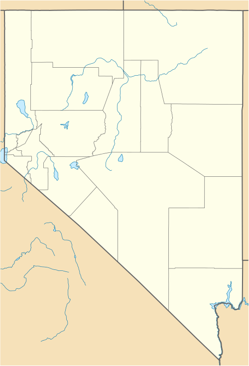
Summerlin is an affluent master-planned community in the Las Vegas Valley of Nevada. It lies at the edge of the Spring Mountains and Red Rock Canyon, on the western periphery of Las Vegas, Nevada in unincorporated Clark County. The community occupies 22,500 acres[1] and includes a variety of land uses, including: residential, commercial, recreational, educational, medical, open space, and cultural. At the 2010 census, Summerlin's population was nearly 100,000, having risen from 59,000 in 2000.[2]
With an average annual household income of $139,061, Summerlin is among the most affluent communities in Nevada.[3] In 2014, Summerlin was named one of the "Best Places to Live in America" by Money.[4]
Summerlin was named after Jean Amelia Summerlin, the mother of Howard R. Hughes Sr. The name "Summerlin" is often used to refer to the adjacent community of Summerlin South as well.
History
In 1952 Howard Robard Hughes, Jr. purchased 25,000 acres (10,000 ha) in Southern Nevada near Las Vegas and called the area "Husite." After Hughes died in 1976, his heirs felt the empty land had the potential to become a master-planned community. They changed the name from "Husite" to "Summerlin", after Hughes' paternal grandmother, Jean Amelia Summerlin, who was born on May 6, 1842 in Keosauqua, Van Buren County, Iowa and died on November 4, 1928 in Los Angeles, California. Summa Corporation was then organized to oversee the Hughes vast business empire and land holdings, including the large parcel of Southern Nevada desert that is the Summerlin of today.
In 1988, Summa Corporation exchanged more than 5,000 acres (2,000 ha) of land adjoining Red Rock Canyon National Conservation Area for 3,000 acres (1,200 ha) of land located south of Summerlin. This landmark land exchange was facilitated by The Nature Conservancy and critically acclaimed by the environmental community. It created a buffer zone to protect Red Rock Canyon National Conservation Area from future development.[5]
Summa Corporation began construction of the Summerlin communities in 1990 but initiated planning and infrastructure construction – including Summerlin Parkway – in the late 1980s.
In 2002, Summa, (kip)known by now as The Howard Hughes Corporation, enacted a second exchange with the Bureau of Land Management, giving more than 1,000 acres (400 ha) of environmentally sensitive land adjacent to Red Rock Canyon National Conservation Area for 900 acres (360 ha) more suitable for development south of Summerlin.
Summerlin is currently home to more than 150 neighborhood and village parks, more than 150 completed miles of the Summerlin Trail System, nine golf courses – including Nevada’s only two Tournament Players Club courses, TPC at Summerlin and TPC Las Vegas, more than a dozen houses of worship, shopping centers, medical and cultural facilities, business parks and 26 public and private schools.
The community is unfolding in villages and today, 19 of 31 total villages are complete or are under development.[6]
Summerlin offers homes in a variety of styles and prices to create a true multi-generational community. As of January 2009, Summerlin has approximately 9,000 acres (3,600 ha) available for development.
Government
Summerlin lies within both an incorporated municipality and unincorporated area. The area north of Charleston Boulevard is within the city of Las Vegas, while property south of Charleston Boulevard is located within unincorporated Clark County. As a planned community, Summerlin is managed by three major master associations (Summerlin North, Summerlin South and Summerlin West). The county portion is generally a part of Summerlin South. The northern portion, east of the 215 beltway, is mostly Summerlin North. The area west of the 215 beltway is Summerlin West. Many individual neighborhoods also have their own subdivision homeowners associations.
Summerlin is developed in villages. Each village features different amenities and residential offerings. Summerlin Centre is the community’s most dynamic village under development as Summerlin’s urban core and includes Downtown Summerlin.
Summerlin has two age-restricted communities, Sun City Summerlin and Siena. Both have their own associations and are not part of the master association.
Associations and villages
- Summerlin North
- Desert Shores
- South Shores
- The Arbors
- The Canyons
- The Crossing
- The Hills
- The Hills South
- The Pueblo
- The Trails
- Sun City Summerlin
- Summerlin South
- Summerlin Centre
- The Gardens
- The Mesa
- Ridgebrook
- The Ridges
- The Willows
- The Cliffs
- The Summit
- Red Rock Country Club
- Siena
- Summerlin West
- The Paseos
- The Vistas
Climate
Summerlin has a hot desert climate (Köppen climate classification: BWh) typical of the Mojave Desert in which it lies. However, owing to its high elevation (ranging from 3,000 feet to 3,500 feet), Summerlin is always cooler than downtown Las Vegas and the Las Vegas Strip, and also receives slightly more precipitation. Clear skies and sunshine are abundant year-around, with 310 days of sunshine per year and exceptionally low dew points and low humidity in every season.
Winters in Summerlin are brief, with only December and January averaging daytime highs below 60 degrees. Temperatures drop to and below freezing on roughly half of all nights in December and January, making Summerlin the leading community in Las Vegas for reaching that benchmark. Snowfall is unusual, occurring once every several years, though several inches can fall at once during a major event.
Spring and fall are dominated by mild to warm days, with occasional surges of hot temperatures. Warming occurs rapidly beginning in March, and comfortably warm temperatures linger through the end of October and into early November. Daytime highs frequently range from the mid 60s to mid 80s, with overnight lows in the mid 40s and mid 50s.
Summers are characterized by lengthy stretches of hot days, with daytime temperatures exceeding 100 degrees on most days in July and August. Overnight lows often remain above 70, and can occasionally remain above 80 during the hottest days of the year.
| TPC Golf Course in Summerlin | ||||||||||||||||||||||||||||||||||||||||||||||||||||||||||||
|---|---|---|---|---|---|---|---|---|---|---|---|---|---|---|---|---|---|---|---|---|---|---|---|---|---|---|---|---|---|---|---|---|---|---|---|---|---|---|---|---|---|---|---|---|---|---|---|---|---|---|---|---|---|---|---|---|---|---|---|---|
| Climate chart (explanation) | ||||||||||||||||||||||||||||||||||||||||||||||||||||||||||||
| ||||||||||||||||||||||||||||||||||||||||||||||||||||||||||||
| ||||||||||||||||||||||||||||||||||||||||||||||||||||||||||||
Recreation
Cycling
Bicycle lanes are provided on most major roads in Summerlin. As the gateway into Red Rock Canyon National Conservation Area, Summerlin is frequented daily by scores of cyclists making their way to the Conservation Area and using the community’s extensive trail system.
Parks
Most Summerlin neighborhoods have small pocket parks that are maintained by one of the Summerlin associations which make up a system of almost 150 parks.[7] Large community parks, which are available for use to all Summerlin residents, are located throughout Summerlin. As of 2008 there are nearly two dozen community parks that feature a variety of recreational amenities. These include league play soccer fields, baseball and t-ball fields, football fields, basketball courts, swimming pools, playgrounds, tennis courts, community centers, sand volleyball courts, horseshoes, bocce ball and shuffleboard courts, a tricycle course, interactive water spray features, motorized toy areas and barbecue areas.
The following parks are owned, maintained and operated by The Summerlin Council.
- Arbors Paseo Park
- The Arbors Sports Park', 18 acres (7.3 ha)[8]
- The Arbors Tennis & Play Park
- Cottonwood Canyon Park
- The Crossing Park, 12.5 acres (5.1 ha)[8]
- The Gardens Park and Community Center
- The Hills Park, 6.7 acres (2.7 ha)[8]
- The Mesa Park
- North Tower Park
- Oxford Park
- The Paseos Park
- The Pueblo Park, 68 acres (28 ha)[8]
- Ridgebrook Park
- South Tower Park
- Spotted Leaf Park
- Summerlin Centre Community Park
- The Trails Linear Park
- The Trails Park and Community Center, 28 acres (11 ha)[8]
- Tree Top Park
- Village Green Park
- The Vistas Community Park
- The Willows Park and Community Center, 12 acres (4.9 ha)[8]
- Willows Paseo Park
Pools
The following pools are owned, maintained and operated by The Summerlin Council:
- The Trails Pool
- The Willows Pool
The following pool is maintained and operated by the City of Las Vegas:
- Pavilion Center Pool
Trails

The Summerlin Trail System is currently more than 150 miles and connects neighborhoods to various amenities throughout the community.[9] Upon completion, the trail system will be more than 200 miles long and will connect to more than 2,000 miles of regional trails, making it one of the most comprehensive and efficient trail systems in the southwest.
The Summerlin Trail System includes five types of planned trails: street-side, village, bike, regional and natural.
In 2008 the Howard Hughes Corporation received the American Trails Developer Award, given to developers in recognition of "quality, well designed multi-use trails systems that are integrated into private developments," for the Summerlin trail system.[10]
Shopping
- Canyon Pointe
- Center Pointe Plaza
- Covington Cross Center
- Downtown Summerlin[11][12][13][14][15]
- The Gardens Plaza
- Pueblo Shopping Center
- South Square Marketplace
- Summit Centre
- Trails Village Center
- Vista Commons
Hotels
- Element Las Vegas, A Westin Hotel
- JW Marriott Las Vegas Resort and Spa
- Red Rock Casino Resort Spa
- Suncoast Hotel and Casino
Education
Public Schools
- D'Vorre and Hal Ober Elementary School
- E.W. Staton Elementary School
- John and Judy Goolsby Elementary School
- John W. Bonner Elementary School
- Linda Givens Elementary School
- Richard H. Bryan Elementary School
- William R. Lummis Elementary School
- Ernest A. Becker, Sr. Middle School
- Sig Rogich Middle School
- Wilbur and Theresa Faiss Middle School
- Cimarron-Memorial High School
- Palo Verde High School
- West Career And Technical Academy
Private Schools
- The Adelson Educational Campus
- Alexander Dawson School
- Bishop Gorman High School
- Faith Lutheran Academy
- Faith Lutheran Jr/Sr High School
- The Meadows School
- The Merryhill School
- St. Elizabeth Ann Seton Catholic School
- The Shenker Academy
- Sholom Schechter Day School of Las Vegas
Higher Education
- College of Southern Nevada (CSN)
- Las Vegas Institute for Advanced Dental Studies, Inc.
- Roseman University of Health Sciences
Notable people
- Sheldon Adelson: American casino magnate.
- Frank Fertitta III: American entrepreneur.
- Lorenzo Fertitta: American entrepreneur.
- Steve Wynn: American businessman and art collector.
- Phil Ruffin: American businessman.
- Sig Rogich: Icelandic/American businessman and former US Ambassador to Iceland.
- Kirk Kerkorian: American business magnate, investor, activist shareholder, and philanthropist.
- David Copperfield: Magician.
- Andre Agassi: American retired professional tennis player.
- Nicolas Cage: American actor and producer.
- Dana White: American businessman, President of the mixed martial arts organization Ultimate Fighting Championship (UFC)
- Brendon Urie: Current vocalist for the American rock band Panic! At The Disco.
- Brandon Marshall: Current NFL Linebacker for the Denver Broncos.
- Penn Jillette: Magician and member of Penn & Teller.
- Ronnie Stanley: Current NFL Offensive Tackle for Baltimore Ravens.
- DeMarco Murray: Current NFL Running Back for Tennessee Titans.
- Alize Jones: Current Tight-End for University of Notre Dame.
- Nicco Fertitta: Current Safety for University of Notre Dame.
- Anu Solomon: Current Quarterback for University of Arizona.
- C.J. Watson: Current NBA basketball player for the Orlando Magic.
- Shabazz Muhammad: Current NBA basketball player for Minnesota Timberwolves.
- Bob Miller: Former Nevada Governor.
- Ross Miller: Former Nevada Secretary of State.
- Joey Gallo: Current MLB player for Texas Rangers.
- Jillian Bell: American actress, writer and comedian.
- Joey Rickard: Current MLB player for Baltimore Orioles.
- Stephen Zimmerman: Current NBA basketball player for the Orlando Magic.
Notes
- ↑ THE SHOPS AT SUMMERLIN
- ↑ Summerlin Economy Continues to Grow
- ↑ 2011-2013 US Census Bureau Economic Characteristics for Summerlin South CDP
- ↑ Summerlin Ranked As One of the Best Places to Live in America
- ↑ "ENVIRONMENTAL STEWARDSHIP". Retrieved 2014-08-25.
- ↑ Summerlin Fact Sheet
- ↑ "THE LIFE". The Howard Hughes Corporation. Retrieved June 8, 2011.
- 1 2 3 4 5 6 "Frequently Asked Questions". Retrieved June 8, 2011.
- ↑ "Parks and Amenities". Summerlink. Retrieved June 8, 2011.
- ↑ "2008 Developer Award Winners". American Trails. Retrieved 1 November 2011.
- ↑ http://www.lasvegassun.com/photos/galleries/2010/jan/10/shops-summerlin-centre/42388/
- ↑ http://www.viewnews.com/2009/VIEW-Mar-10-Tue-2009/CentennialHills/27314866.html
- ↑ http://www.ktnv.com/Global/story.asp?s=11006631
- ↑ http://www.lasvegassun.com/photos/galleries/2010/jan/10/shops-summerlin-centre/
- ↑
References
- The Howard Hughes Corporation, 2009
External links
 |
Lone Mountain |  | ||
| Red Rock Canyon | |
Las Vegas | ||
| ||||
| | ||||
| Spring Valley |
Coordinates: 36°11′N 115°20′W / 36.183°N 115.333°W
