Sunset Peak (Jammu and Kashmir)
| Sunset Peak | |
|---|---|
| Romesh Thong | |
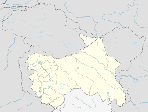 Sunset Peak Location in Jammu and Kashmir | |
| Highest point | |
| Elevation | 4,745 m (15,568 ft) [1] |
| Prominence | 1,942 m (6,371 ft) [1] |
| Listing | Ultra |
| Coordinates | 33°40′48″N 74°32′27″E / 33.68000°N 74.54083°ECoordinates: 33°40′48″N 74°32′27″E / 33.68000°N 74.54083°E [1] |
| Geography | |
| Location | Shopian district, Jammu and Kashmir, India |
| Parent range | Pirpanjal Range, Himalayas |
| Climbing | |
| First ascent | 1901 by Dr Arthur Neve, Dr Ernest Neve (Brothers), United Kingdom |
| Easiest route | North Ridge: glacier/snow/ice climb |
Sunset Peak also known as Romesh Thong[2] is a mountain massif with a peak elevation[3] of 4,745 metres (15,568 ft), in Shopian district of Jammu and Kashmir. It is the highest peak of this massif, the other peak is Tatakooti Peak 4,725 m (15,502 ft), Sunset Peak, as the name suggests lies in the west of The Vale of Kashmir as a whole. It is located 40 km west of Shopian town, 105 km southwest of Srinagar, the capital of Jammu and Kashmir.
Mountaineering
Early exploration of the Pirpanjal Range was carried by Thomas Montgomerie and Godwin Austen in 1856.[4] The first ascent of the summit was made in1901 by Dr Arthur Neve and Dr Ernest Neve, the British brothers who took the route via Yusmarg Konsar Nag and climbed the summit through north face.[5]
The massif is accessed by 105 km (65 mi) by road from Srinagar. The Mughal Road passes through the base of this mountain which lies on the right side of the road.
References
- 1 2 3 "The Karakoram, Pakistan Himalaya and India Himalaya". peaklist.org. Retrieved 2012-06-15.
- ↑ "Srinagar and its Environs". koausa.org. Retrieved 2012-06-12.
- ↑ "Kashmir Information". kashmirinformation.com. Retrieved 2012-06-12.
- ↑ "Henry Haversham Godwin-Austen (1834-1923) The Baltoro Glacier Karakoram". christies.com. Retrieved 2012-06-12.
- ↑ "Memories of early Kashmir climbing". himalayanclub.com. Retrieved 2012-06-12.