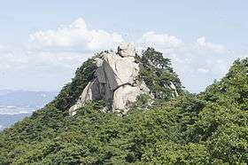
Suraksan
| Suracksan | |
|---|---|
|
 Suracksan Location | |
| Highest point | |
| Elevation | 637.7 m (2,092 ft) |
| Coordinates | 37°41′46″N 127°04′55″E / 37.69611°N 127.08194°E |
| Geography | |
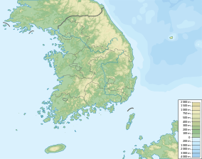
| Location | South Korea |
| Climbing | |
| Easiest route | Jangam Station |
| Korean name | |
| Hangul | 수락산 |
|---|---|
| Hanja | 水落山 |
| Revised Romanization | Suraksan |
| McCune–Reischauer | Suraksan |
Suraksan is a mountain in South Korea. It extends across the district of Nowon-gu in Seoul, the national capital, and the cities of Namyangju and Uijeongbu, in the province of Gyeonggi-do. It has an elevation of 637.7 m (2,092 ft).[1]
See also
Notes
- ↑ An 2004, p.332.
References
- An Gyeong-ho (2004). 한국 200 명산 (200 Korean Mountains). Seoul: 깊은솔 (Gipeunsol). ISBN 89-89917-14-X.
This article is issued from Wikipedia - version of the 3/14/2015. The text is available under the Creative Commons Attribution/Share Alike but additional terms may apply for the media files.