Suri District
| Suri District بخش سوري | |
|---|---|
| District | |
| Coordinates: 33°18′N 47°26′E / 33.300°N 47.433°ECoordinates: 33°18′N 47°26′E / 33.300°N 47.433°E | |
| Country |
|
| Province | Lorestan |
| County | Rumeshkhan |
| Population (2006)[1] | |
| • Total | 16,262 |
| Time zone | IRST (UTC+3:30) |
| • Summer (DST) | IRDT (UTC+4:30) |
The Suri District (Persian: بخش سوري) is a district (bakhsh) in Rumeshkhan County, Lorestan Province, Iran. At the 2006 census, it had 16,262 inhabitants, living in 3,350 households.[1] The district is entirely rural with two rural districts: Suri Rural District, and Rumiani Rural District, with a total of nineteen villages.[2][3]
Mount Vyznhar (Vznyar), the highest mountain in the county, is located in Suri District. On its slopes are the ruins of Kohzad Castle.[3]
Notes and references
- 1 2 "Census of the Islamic Republic of Iran, 1385 (2006)". Islamic Republic of Iran. Archived from the original (Excel) on 2011-11-11.
- ↑ "وزارت کشور شماره ۱۰۶۲۲۸/ت۴۹۲۴۳هـ" [No. 106228/49243 of the Ministry of Interior] (in Persian). Laws and Regulations Portal of the Islamic Republic of Iran. Archived from the original on 28 September 2015.
- 1 2 "Rumeshkhan: Geographical location" (in Persian). Lorestan province. Archived from the original on 26 September 2015.
| Capital | 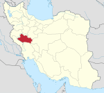 | ||||||||||||||||||||||||||||||||||||||
|---|---|---|---|---|---|---|---|---|---|---|---|---|---|---|---|---|---|---|---|---|---|---|---|---|---|---|---|---|---|---|---|---|---|---|---|---|---|---|---|
| Counties and cities | |||||||||||||||||||||||||||||||||||||||
| Sights |
| ||||||||||||||||||||||||||||||||||||||
| populated places | |||||||||||||||||||||||||||||||||||||||
| Capital | |||||||||||||||||||||||||||||||
|---|---|---|---|---|---|---|---|---|---|---|---|---|---|---|---|---|---|---|---|---|---|---|---|---|---|---|---|---|---|---|---|
| Districts |
| ||||||||||||||||||||||||||||||
This article is issued from Wikipedia - version of the 2/16/2016. The text is available under the Creative Commons Attribution/Share Alike but additional terms may apply for the media files.