Svibno
| Svibno | |
|---|---|
|
Postcard of Svibno | |
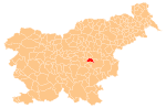
 Svibno Location in Slovenia | |
| Coordinates: 46°3′49.17″N 15°5′50.37″E / 46.0636583°N 15.0973250°ECoordinates: 46°3′49.17″N 15°5′50.37″E / 46.0636583°N 15.0973250°E | |
| Country |
|
| Traditional region | Lower Carniola |
| Statistical region | Lower Sava |
| Municipality | Radeče |
| Area | |
| • Total | 3.61 km2 (1.39 sq mi) |
| Elevation | 538.6 m (1,767.1 ft) |
| Population (2002) | |
| • Total | 183 |
| [1] | |

Svibno (pronounced [ˈsʋiːbnɔ]; German: Scharfenberg[2]) is a settlement in the Municipality of Radeče in eastern Slovenia. The area is part of the historical region of Lower Carniola. The municipality is now included in the Lower Sava Statistical Region; until January 2014 it was part of the Savinja Statistical Region.[3] It includes the hamlets of Malarija, Cumer, Pristava, Rasberg, and Podlog.[4]
The local parish church is dedicated to the Holy Cross and belongs to the Roman Catholic Archdiocese of Ljubljana. Its earliest phases date to the 13th century, but it was rebuilt and restyled over the centuries.[5]
References
- ↑ Statistical Office of the Republic of Slovenia
- ↑ Leksikon občin kraljestev in dežel zastopanih v državnem zboru, vol. 6: Kranjsko. 1906. Vienna: C. Kr. Dvorna in Državna Tiskarna, p. 88.
- ↑ Radeče municipal site
- ↑ Savnik, Roman, ed. 1976. Krajevni leksikon Slovenije, vol. 3. Ljubljana: Državna založba Slovenije. pp. 197–198.
- ↑ "EŠD 2410". Registry of Immovable Cultural Heritage (in Slovenian). Ministry of Culture of the Republic of Slovenia. Retrieved 20 May 2011.
External links
 Media related to Svibno at Wikimedia Commons
- Svibno at Geopedia
| Settlements | Administrative centre: Radeče
|  | ||||||
|---|---|---|---|---|---|---|---|---|
| Landmarks |
| |||||||
This article is issued from Wikipedia - version of the 1/10/2016. The text is available under the Creative Commons Attribution/Share Alike but additional terms may apply for the media files.