Taypi Qullu (Sajama)
This article is about the mountain in the Sajama Province, Oruro Department, Bolivia. For other uses, see Taypi Qullu.
| Taypi Qullu | |
|---|---|
 Taypi Qullu Location in Bolivia | |
| Highest point | |
| Elevation | 4,920 m (16,140 ft) [1] |
| Coordinates | 18°06′42″S 68°21′43″W / 18.11167°S 68.36194°WCoordinates: 18°06′42″S 68°21′43″W / 18.11167°S 68.36194°W |
| Geography | |
| Location | Bolivia, Oruro Department |
| Parent range | Andes |
Taypi Qullu (Aymara taypi center, middle, qullu mountain,[2] "center mountain", hispanicized spelling Taypi Kkollu) is a mountain in the Andes of Bolivia which reaches a height of approximately 4,920 m (16,140 ft). It is located in the Oruro Department, Sajama Province, Turco Municipality. Taypi Qullu lies southwest of Jach'a Apachita.[1][3]
References
- 1 2 Bolivian IGM map 1:50,000 Estancia Marcarani Hoja 5939-IV
- ↑ Radio San Gabriel, "Instituto Radiofonico de Promoción Aymara" (IRPA) 1993, Republicado por Instituto de las Lenguas y Literaturas Andinas-Amazónicas (ILLLA-A) 2011, Transcripción del Vocabulario de la Lengua Aymara, P. Ludovico Bertonio 1612 (Spanish-Aymara-Aymara-Spanish dictionary)
- ↑ "Curaguara de Carangas". Retrieved March 5, 2016. (unnamed)
Capital: Oruro | ||
| Provinces | 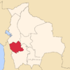 | |
| Municipalities (and seats) |
| |
This article is issued from Wikipedia - version of the 3/5/2016. The text is available under the Creative Commons Attribution/Share Alike but additional terms may apply for the media files.