Tehachapi Municipal Airport
| Tehachapi Municipal Airport | |||||||||||
|---|---|---|---|---|---|---|---|---|---|---|---|
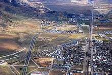 Aerial: KTSP Airport area | |||||||||||
| IATA: TSP – ICAO: KTSP – FAA LID: TSP | |||||||||||
| Summary | |||||||||||
| Airport type | Public | ||||||||||
| Operator | City of Tehachapi | ||||||||||
| Location | Tehachapi, California | ||||||||||
| Elevation AMSL | 4,001 ft / 1,219.5 m | ||||||||||
| Coordinates | 35°08′06″N 118°26′21″W / 35.13500°N 118.43917°WCoordinates: 35°08′06″N 118°26′21″W / 35.13500°N 118.43917°W | ||||||||||
| Website | Official website | ||||||||||
| Runways | |||||||||||
| |||||||||||
Tehachapi Municipal Airport (IATA: TSP, ICAO: KTSP, FAA LID: TSP) is a public airport located in Tehachapi, serving Kern County, California, USA. This general aviation airport covers 264 acres (107 ha) and has one runway.[1]
The airport was established in 1929 originally to support an air mail route between Tehachapi and Bakersfield, but following the 1952 Kern County earthquake, Tehachapi became inaccessible by roads or rail, and the airport served as the destination for an emergency relief airlift for several weeks. There are hangars and an industrial park on the south side of the airport, and in 2009 the city was planning to begin an expansion of the airport to include a taxiway and hangars on the north side.[2] In 1974, the airport had scheduled passenger airline service operated by Golden West Airlines to Los Angeles (LAX) with de Havilland Canada DHC-6 Twin Otter commuter turboprop aircraft.[3]
See also
- Mountain Valley Airport, privately owned gliderport also located in Tehachapi
- List of airports in Kern County, California
References
- ↑ "Airport". City of Tehachapi. Retrieved 2008-08-17.
- ↑ Don Haley (February 13, 2007). "Tehachapi Municipal Airport - Positive Growth". California Pilots Association. Retrieved October 10, 2012.
- ↑ http://www.departedflights.com, April 15, 1974 Golden West Airlines route map
External links
- Tehachapi Composite Squadron 46, Civil Air Patrol
- Flying into Tehachapi — by Frank Holbert.
- Tehachapi Municipal Airport-related articles in the Tehachapi News:
- FAA Airport Master Record for TSP (Form 5010 PDF)
- Resources for this airport:
- FAA airport information for TSP
- AirNav airport information for KTSP
- ASN accident history for TSP
- FlightAware airport information and live flight tracker
- NOAA/NWS latest weather observations
- SkyVector aeronautical chart, Terminal Procedures