Tehla
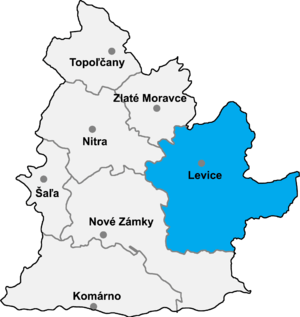
Location of Levice District in the Nitra Region
Tehla (Hungarian: Töhöl) is a village and municipality in the Levice District in the Nitra Region of Slovakia.
History
In historical records the village was first mentioned in 1251.
Geography
The village lies at an altitude of 172 metres and covers an area of 19.093 km². It has a population of about 554 people.
Ethnicity
The village is about 75% Slovak, 22% Magyar and 3% Gypsy.
Facilities
The village has a public library and football pitch.
External links
Coordinates: 48°11′N 18°23′E / 48.183°N 18.383°E
This article is issued from Wikipedia - version of the 2/16/2016. The text is available under the Creative Commons Attribution/Share Alike but additional terms may apply for the media files.