Théols
| Théols | |
|---|---|
 river near Issoudun | |
| Basin | |
| Main source |
Les Sapins, Bommiers 150 m (490 ft) 46°47′41″N 1°58′19″E / 46.7946°N 1.9719°E |
| River mouth |
Arnon, Lazenay 112 m (367 ft) 47°04′12″N 2°03′12″E / 47.07°N 2.0534°ECoordinates: 47°04′12″N 2°03′12″E / 47.07°N 2.0534°E |
| Progression | Arnon→ Cher→ Loire→ Atlantic Ocean |
| Basin size | 797 km2 (308 sq mi) |
| Physical characteristics | |
| Length | 42.3 km (26.3 mi)[1] |
| Discharge |
|
| Features | |
| Tributaries |
|
| Sources | ,[1] Géoportail and Banque Hydro |
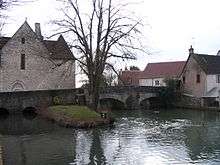
The Théols is a French river, that flows in the Boischaut natural region.
Geography
The river is 42.3 km long[1] and crops at 150 m near Bommiers[1] in the Boischaut natural region; it joins the Arnon near Lazenay.[1]
Hydrology
The river debit was studied from (1971 to 1975) at Sainte-Lizaigne (located about 10 km from its confluent with the Arnon). The surface observed was 797 km², over 90% of its watershed.
The river has an average debit of 2.99 m3/s at Sainte-Lizaigne.
The Théols is a plain river that varies little. It presents seasonal debital fluctuations. High waters are around from February to May, with medium debits from 3,5 to 5 m/s (peak February–March). From April, the flow rate decreases regularly toward low water (which lasts from August to October).
Floods are seldom important.
The daily maximal debit recorded at Sainte-Lizaigne was 32.3m3/s on March 22, 1974. Its yearly drainage basin precipitation is currently of 118 mm, just over a third of the national average (320 mm), which is also below the average of the Loire basin (+/- 245 mm) and the Arnon (200 mm). The discharge was hence of 3,75 L/s and by km² of basin.
Fish
The river is lush in : bleak, Barbel, largemouth bass, cream, pike, crucian, roach, gudgeon, rudd, perch, tench, zander and catfish.