The Deepings

The Deepings (grid reference TF150094) are a series of settlements in the south of Lincolnshire in England.
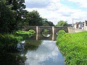
The adjoining villages and a town are in the Lincolnshire fens near the River Welland, some 8 miles to the north of Peterborough and 10 miles or so east of Stamford. The area is just north of the Peterborough border. The Deepings include: Deeping St James, Deeping St Nicholas, Market Deeping and West Deeping. Frognall, Stowgate, Hop Pole and Tongue End are all within the various civil parishes.
Another village that is sometimes included in The Deepings is Deeping Gate, a small hamlet across the River Welland in Cambridgeshire.
The area is very low-lying, and gave The Deepings their name (a Saxon name translatable as either 'deep places' or 'deep lands'). The villages are mentioned in the Domesday Book. Deeping Fen lies to the North, and the drainage of it was an important part of seventeenth and eighteenth century land reclamation. It is now the responsibility of the Welland and Deepings Internal Drainage Board.[1]
History
Drainage of the area dates back at least as far as the Romans, and the Car Dyke, but the capital involved always required a strong state, and rich men, to improve the land.
In William the Conqueror's reign Richard de Rulos who was the Lord and Owner of part of Deeping Fen "and was much addicted to good husbandry, such as tillage and breeding of cattle. took in a great part of the common fen adjacent and converted it into several, for meadows and pastures. He also made an Inclosure from the Chapel of St. Guthlac of all his lands up to the Cardyke, excluding the river Welland within a mighty bank; because almost every year his meadows lying near that stream were overflowed. upon this bank he erected tenements and cottages and in a short time made it a large town, whereunto he assigned gardens and arable fields, By thus embanking the river he reduced the low grounds, which before that time were deep lakes and impassable fens, (hence the name Deep-ing or Deep Meadow), into most fruitful fields and pastures ; and the most humid and moorish parts to a garden of pleasure. Having by this good husbandry brought the soil to that fertile condition, he converted the chapel of St Guthlac into a church, the place now being called Market Deeping, By the like means of banking and draining he also made a village dedicated to St. James in the very pan of Pudlington, and by much labour and charge reduced it into fields, meadows, and pasture, which is now called Deeping St. James -- W.H. Wheeler[2] Quoting William Dugdale.[3] Dugdale drew heavily on William Camden's Brittania which tells the same story in nearly the same words.[4][5]
See also
References
- ↑ Welland and Deepings IDB
- ↑ Wheeler M.Inst.C.E, William Henry (1896). A History of the Fens of South Lincolnshire, being a description of the rivers Witham and Welland and their estuary, and an account of the Reclamation, Drainage, and Enclosure of the fens adjacent thereto. (2nd ed.). J.M. Newcombe (Boston), Simpkin, Marshall & Co. (London). p. 314. doi:10.1680/ahotfosl2e.50358.
- ↑ Dugdale, William (1662). History of Imbanking and Drayning of Divers Fens and Marshes. London.
- ↑ Camden, William (1586). Britannia.
- ↑ "Modern translation of relevant part of Camden's Brittania".
Further reading
History of the Deepings (or Three Deepings in a Row) by Florence A. Day (n.d.)
The Medieval Fenland by H. C. Darby (first published by The Cambridge University Press, 1940, reprinted by David & Charles, 1974)
England Portal | |
| Unitary authorities | |
| Boroughs or districts | |
| Major settlements |
|
| Topics | |
Coordinates: 52°40′12″N 0°18′03″W / 52.67012°N 0.30076°W