The Map Library
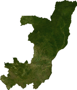
Satellite image of Republic of Congo
- The Map Library should not be confused with the Map Library of The British Museum.
The Map Library is a project of The Map Maker Trust charity, and supported by Map Maker Ltd., for the supplying of free GIS data. The project website also hosts free conversion software for raster and vector files. As of November 2008, the only data sets available were for the continents of Africa and Central America.
Statement of purpose
From the website...
- The idea behind the Map Library is that the lack of good, simple maps is a serious obstacle to development in all kinds of fields, from health care to urban management, from de-mining to environmental protection. The library's purpose is two fold: to make public domain mapping data more readily available for developing countries, and to provide free, easy to use software to facilitate map making by non-experts. The Map Library delivers data and software both on the internet and by post on CD for those with poor or no internet access.
Data format and conversion
The project data is managed in part by two pieces of software, each supporting different file formats and conversions.
- Raster Converter handles ECW files: these can be converted to BMP, TIFF, and with external libraries, JPEG, and JPEG 2000.
- Vector Converter handles MLB ("map-library") files: these files can be converted to data files for ArcView, AutoCAD, and several other formats.
Data sources
The project uses data from NASA mapping projects, Famine Early Warning Systems Network, and the National Geospatial-Intelligence Agency.
See also
External links
This article is issued from Wikipedia - version of the 3/23/2013. The text is available under the Creative Commons Attribution/Share Alike but additional terms may apply for the media files.