Tidenham
| Tidenham | |
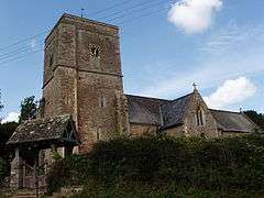 Tidenham Church |
|
 Tidenham |
|
| Population | 5,486 |
|---|---|
| OS grid reference | ST5558695942 |
| District | Forest of Dean |
| Shire county | Gloucestershire |
| Region | South West |
| Country | England |
| Sovereign state | United Kingdom |
| Post town | CHEPSTOW |
| Postcode district | NP16 |
| Dialling code | 01291 |
| Police | Gloucestershire |
| Fire | Gloucestershire |
| Ambulance | South Western |
| EU Parliament | South West England |
| UK Parliament | Forest of Dean |
|
|
Coordinates: 51°39′38″N 2°38′37″W / 51.6605°N 2.6435°W
Tidenham (/ˈtɪdənəm/[1]) is a village and civil parish in the Forest of Dean of west Gloucestershire, England, adjoining the Welsh border. Tidenham is bounded by the River Wye (which forms the Welsh border) to the west and the River Severn to the south. Offa's Dyke runs through the western part of the parish, terminating at Sedbury cliff above the River Severn.
The parish includes the villages of Tidenham, Beachley, Boughspring, Sedbury, Tutshill and Woodcroft, and according to the United Kingdom Census 2001 had a population of 5,316, increasing to 5,486 at the 2011 census.[2] At one time it included the now-abandoned village of Lancaut. Tidenham, Beachley and Woolaston were added to Gloucestershire by the first Act of Union of England and Wales in 1536; previously they had been part of the Marcher lordship of Striguil.
The stretch of the Wye Valley lying within the parish includes several popular rock climbing cliffs at Wintour's Leap near Woodcroft and the Devil's Pulpit, a famous rock formation and viewpoint overlooking Tintern Abbey. The parish also contains Tidenham Chase - the largest remaining fragment of lowland heathland in Gloucestershire. Also notable is the former Dayhouse Quarry which, after providing traffic for the remaining fragment of the former railway to Monmouth, is now home to the National Diving and Activity Centre. The railway has been the centre of several attempts to re-open it, but the overgrown track tells the result of these efforts to restore Tidenham station quite effectively. It ran through Tintern up the Wye Valley, and joined the mainline near Tidenham.
Located as it is between the Wye and Severn the area has always been important as a site for crossing these rivers. Historically ferries crossed the River Severn from Beachley to Aust and now this route is followed by the Severn Bridge one of whose piers stands on the Beachley peninsula although the bridge itself begins in Wales. From Roman times the River Wye has been bridged between Tutshill and Chepstow. The village, once known as Dyddanhamme, is one of the most heavily documented Saxon villages in Britain and has been home to a grand manor of some kind since at least the 6th century AD. The Saxon structure was owned by the Abbott of Bath, who retained some of the documents on what was then an important location until the Dissolution of the Monasteries. The current building is of Georgian design, overlooking the river and conveniently located adjacent to the Norman parish church.
Governance
An electoral ward in the same name exists. The population and area of the ward is identical to the parish quoted above.
Railways
The area is served by Chepstow railway station on the Gloucester to Newport Line.
Wye Valley Railway (currently closed)
The area was previously served by Tidenham railway station on the Wye Valley Railway that was a scenic line which ran from Chepstow via Tintern to Monmouth Troy which closed in 1959.
See also
References
- ↑ G.M. Miller, BBC Pronouncing Dictionary of British Names (Oxford UP, 1971), p. 148.
- ↑ "Parish population 2011.Retrieved 28 March 2015".
External links
| Wikimedia Commons has media related to Tidenham. |