Tinglof Peninsula
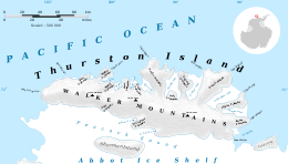
Map of Thurston Island.
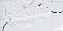
Satellite image of Thurston Island.
Tinglof Peninsula (72°2′S 100°6′W / 72.033°S 100.100°WCoordinates: 72°2′S 100°6′W / 72.033°S 100.100°W) is an ice-covered peninsula, 10 nautical miles (18 km) long, between Henry and Wagoner Inlets on the north side of Thurston Island. Delineated from aerial photographs taken by U.S. Navy Operation Highjump in December 1946. Named by Advisory Committee on Antarctic Names (US-ACAN) for Ivor Tinglof, tractor mechanic of the Byrd Antarctic Expedition in 1933-35, who built at Little America the first heavy cargo sleds for use in the Antarctic.
Maps
- Thurston Island – Jones Mountains. 1:500000 Antarctica Sketch Map. US Geological Survey, 1967.
- Antarctic Digital Database (ADD). Scale 1:250000 topographic map of Antarctica. Scientific Committee on Antarctic Research (SCAR). Since 1993, regularly upgraded and updated.
![]() This article incorporates public domain material from the United States Geological Survey document "Tinglof Peninsula" (content from the Geographic Names Information System).
This article incorporates public domain material from the United States Geological Survey document "Tinglof Peninsula" (content from the Geographic Names Information System).
This article is issued from Wikipedia - version of the 1/31/2016. The text is available under the Creative Commons Attribution/Share Alike but additional terms may apply for the media files.