Touho
| Touho | |
|---|---|
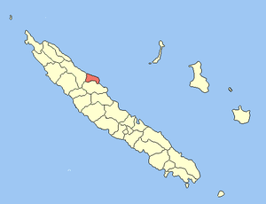 Location of the commune (in red) within New Caledonia | |
| Coordinates: 20°47′S 165°14′E / 20.79°S 165.23°ECoordinates: 20°47′S 165°14′E / 20.79°S 165.23°E | |
| Country | France |
| Sui generis collectivity | New Caledonia |
| Province | North Province |
| Government | |
| • Mayor | Alphonse Poinine |
| Area1 | 283.0 km2 (109.3 sq mi) |
| Population (2014 census)2 | 2,087 |
| • Density | 7.4/km2 (19/sq mi) |
| Ethnic distribution | |
| • 1996 census |
Kanaks 83.6% Europeans 12.8% Polynesians 0.5% Other 3.1% |
| INSEE/Postal code | 98830 / 98831 |
| Elevation |
0–1,069 m (0–3,507 ft) (avg. 10 m or 33 ft) |
|
1 New Caledonia Land Register (DITTT) data, which exclude lakes and ponds larger than 1 km² (0.386 sq mi or 247 acres) as well as the estuaries of rivers. 2 Population without double counting: residents of multiple communes (e.g., students and military personnel) only counted once. | |
Touho is a municipality (commune) in the North Province of New Caledonia, an overseas territory of France in the Pacific Ocean. Touho lies on the east coast of the main island (Grande Terre) and is served by a road and an airfield.
The vocational school, Lycée Professionnel Augustin Ty,[1] was officially opened in 1994. It is located directly opposite the airport.
References
- ↑ "Lycée Augustin Ty - Touho". Ac-noumea.nc. Retrieved 2015-11-20.
| Wikimedia Commons has media related to Touho. |
| Provinces | |
|---|---|
| Communes | |
This article is issued from Wikipedia - version of the 12/21/2015. The text is available under the Creative Commons Attribution/Share Alike but additional terms may apply for the media files.