Tsunamis in lakes
A tsunami is defined as a series of water waves caused by the displacement of a large volume of a body of water, such as an ocean. This is misleading as destructive water waves are not restricted to the ocean, in the case of this article the body of water being investigated will be a lake rather than an ocean. Tsunamis in lakes are becoming increasingly important to investigate as a hazard, due to the increasing popularity for recreational uses, and increasing populations that inhabit the shores of lakes. Tsunamis generated in lakes and reservoirs are of high concern because it is associated with a near field source region which means a decrease in warning times to minutes or hours.
Causes
Inland tsunami hazards can be generated by many different types of earth movement. Some of these include earthquakes in or around lake systems, landslides, debris flow, rock avalanches, and glacier calving. Volcanogenic processes such as gas and mass flow characteristics are discussed in more detail below.
Earthquakes

Tsunamis in lakes can be generated by fault displacement beneath or around lake systems. Faulting shifts the ground in a vertical motion through reverse, normal or oblique strike slip faulting processes, this displaces the water above causing a tsunami (Figure 1). The reason strike-slip faulting does not cause tsunamis is because there is no vertical displacement within the fault movement, only lateral movement resulting in no displacement of the water. In an enclosed basin such as a lake, tsunamis are referred to as the initial wave produced by coseismic displacement from an earthquake, and the seiche as the harmonic resonance within the lake.[1]
In order for a tsunami to be generated certain criteria is required:
- Needs to occur just below the lake bottom.
- Earthquake is of high or moderate magnitude typically over magnitude four.
- Displaces a large enough volume of water to generate a tsunami.
These tsunamis are of high damage potential due to being within a lake, making them of a near field source. This means a vast decrease in warning times, resulting in organised emergency evacuations after the generation of the tsunami being virtually impossible, and due to low lying shores even small waves lead to substantial flooding.[2] Planning and education of residents needs to be done beforehand, so that when an earthquake is felt they know to head to higher ground and what routes to take to get there.
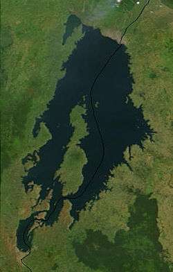
Lake Tahoe
Lake Tahoe is an example of a lake that is in danger of having a tsunami due to faulting processes. Lake Tahoe in California and Nevada USA lies within an intermountain basin bounded by faults, with most of these faults at the lake bottom or hidden in glaciofluvial deposits. Lake Tahoe has had many prehistoric eruptions and in studies of the lake bottom sediments, a 10m high scarp has displaced the lake bottom sediments, indicating that the water was displaced by the same magnitude, as well as generating a tsunami. A tsunami and seiche in Lake Tahoe can be treated as shallow-water long waves as the maximum water depth is much smaller than the wavelength. This demonstrates the interesting impact that lakes have on the tsunami wave characteristics, as it is very different from ocean tsunami wave characteristics due to the ocean being deeper, and lakes being relatively shallow in comparison. With ocean tsunami waves amplitudes only increase when the tsunami gets close to shore, in lake tsunami waves are generated and stay in a shallow environment.
This would have a major impact on the 34,000 permanent residences along the lake, not to mention the impact on tourism in the area. Tsunami run-ups would leave areas near the lake inundated due to permanent ground subsidence attributed to the earthquake, with the highest run-ups and amplitudes being attributed to the seiches rather than the actual tsunami. The reason seiches cause so much damage is due to resonance within the bays reflecting the waves where they combine to make larger standing waves. For more information see seiches.[3] Lake Tahoe also experienced a massive collapse of the western edge of the basin that formed McKinney Bay around 50,000 years ago. Is thought to have generated a tsunami/seiche wave with a height approaching 330 ft (100 m).[4]
Sub-aerial mass flows
Sub-aerial mass flows (landslides or rapid mass wasting) happen when a large amount of sediment becomes unstable, this can happen for example from the shaking from an earthquake, or saturation of the sediment initiating a sliding layer. This volume of sediment then flows into the lake giving a sudden large displacement of water. Tsunamis generated by sub aerial mass flows are defined in terms of the first initial wave being the tsunami wave and any tsunamis in terms of sub aerial mass flows are characterised into three zones. A splash zone or wave generation zone, this is the region were landslides and water motion are coupled and it extends as far as the landslide travels. Near field area, were the concern is based on the characteristics of the tsunami wave such as amplitude and wavelength which are crucial for predictive purposes. Far field area, the process is influenced mainly by dispersion characteristics and is not often used when investigating tsunamis in lakes, as most lake tsunamis are related only to near field processes.[5]
A modern example of a landslide into a reservoir lake, overtopping a dam, occurred in Italy with the Vajont Dam disaster in 1963. Evidence exists in paleoseismological evidence and other sedimentary core sample proxies of catastrophic rock failures of landslide-triggered lake tsunamis worldwide, including in Lake Geneva during AD 563.[6]
New Zealand example
In the event of the Alpine fault in New Zealand rupturing in the South Island, it is predicted that there would be shaking of approximately magnitude eight in the lake side towns of Queenstown (Lake Wakatipu) and Wanaka (Lake Wanaka). These could possibly cause sub-aerial mass flows that could generate tsunamis within the lakes, this would have a devastating impact on the 15,453 residents (2006 Census) who occupy these lake towns, not only in the potential losses of life and property, but the damage to the booming tourism industry would take years to rebuild.
The Otago Regional Council, responsible for the area, has recognised that in such an event, tsunamis could occur in both lakes but have yet to learn any more about it. This is interesting as if an event was to happen in peak seasons such as summer around Christmas, or in the snow season when the population of these areas nearly double, it would pose a huge management issue. The reason for this huge management issue is the volume of people in these areas would be unknown and supplies and aid would be insufficient. In summer a lot of temporary structures such as tents are put up on the lake shore, these tents provide no protection from a tsunami wave. This is why it is so important to investigate what would happen in such an event so that people can be educated in order to reduce vulnerability in these areas.
Volcanogenic processes
In this article the focus is on tsunamis generated in lakes by volcanogenic processes in terms of gas build up causing violent lake over turns, with other processes such as pyroclastic flows not accounted for, as it requires more complex modelling . Lake overturns can be incredibly dangerous and occur when gas trapped at the bottom of the lake is heated by rising magma causing an explosion and lake overturn; an example of this is Lake Kivu.
Lake Kivu
Lake Kivu, one of the African Great Lakes, lies on the border between the Democratic Republic of the Congo and Rwanda, and is part of the East Africa Rift. Being part of the rift means it is affected by volcanic activity beneath the lake. This has led to a buildup of methane and carbon dioxide at the bottom of the lake, which can lead to violent limnic eruptions.
Limnic eruptions (also called "lake over turns") are due to volcanic interaction with the water at the bottom of the lake that has high gas concentrations, this leads to heating of the lake and this rapid rise in temperature would spark a methane explosion displacing a large amount of water, followed nearly simultaneously by a release of carbon dioxide. This carbon dioxide would suffocate large numbers of people, with a possible tsunami generated from water displaced by the gas explosion affecting all of the 2 million people who occupy the shores of Lake Kivu.[7] This is incredibly important as the warning times for an event such as a lake overturn is incredibly short in the order of minutes and the event itself may not even be noticed. Education of locals and preparation is crucial in this case and a lot of research in this area has been done in order to try to understand what is happening within the lake, in order to try to reduce the effects when this phenomenon does happen.
A lake turn-over in Lake Kivu occurs from one of two scenarios. Either (1) up to another hundred years of gas accumulation leads to gas saturation in the lake, resulting in a spontaneous outburst of gas originating at the depth at which gas saturation has exceeded 100%, or (2) a volcanic or even seismic event triggers a turn-over. In either case a strong vertical lift of a large body of water results in a plume of gas bubbles and water rising up to and through the water surface. As the bubbling water column draws in fresh gas-laden water, the bubbling water column widens and becomes more energetic as a virtual "chain reaction" occurs which would look like a watery volcano. Very large volumes of water are displaced, vertically at first, then horizontally away from the centre at surface and horizontally inwards to the bottom of the bubbling water column, feeding in fresh gas-laden water. The speed of the rising column of water increases until it has the potential to rise 25m or more in the centre above lake level. The water column has the potential to widen to well in excess of a kilometre, in a violent disturbance of the whole lake. The watery volcano may take as much as a day to fully develop while it releases upwards of 400 billion cubic metres of gas (~12tcf). Some of these parameters are uncertain, particularly the time taken to release the gas and the height to which the water column can rise. As a secondary effect, particularly if the water column behaves irregularly with a series of surges, the lake surface will both rise by up to several metres and create a series of tsunamis or waves radiating away from the epicentre of the eruption. Surface waters may simultaneously race away from the epicentre at speeds as high as 20-40m/second, slowing as distances from the centre increase. The size of the waves created is unpredictable. Wave heights will be highest if the water column surges periodically, resulting in wave heights is great as 10-20m. This is caused by the ever-shifting pathway that the vertical column takes to the surface. No reliable model exists to predict this overall turnover behaviour. For tsunami precautions it will be necessary for people to move to high ground, at least 20m above lake level. A worse situation may pertain in the Ruzizi River where a surge in lake level would cause flash-flooding of the steeply sloping river valley dropping 700m to Lake Tanganyika, where it is possible that a wall of water from 20-50m high may race down the gorge. Water is not the only problem for residents of the Kivu basin; the more than 400 billion cubic metres of gas released creates a denser-than-air cloud which may blanket the whole valley to a depth of 300m or more. The presence of this opaque gas cloud, which would suffocate any living creatures with its mixture of carbon dioxide and methane laced with hydrogen sulphide, would cause the majority of casualties. Residents would be advised to climb to at least 400m above the lake level to ensure their safety. Strangely the risk of a gas explosion is not great as the gas cloud is only about 20% methane in carbon dioxide, a mixture that is difficult to ignite.
Hazard mitigation
Hazard mitigation for tsunamis in lakes is immensely important in the preservation of life, infrastructure and property. In order for hazard management of tsunamis in lakes to function at full capacity there are four aspects that need to be balanced and interacted with each other, these are:
- Readiness (preparedness for a tsunami in the lake)
- Evacuation plans
- Making sure equipment and supplies are on standby in case of a tsunami
- Education of locals on what hazard is posed to them and what they need to do in the event of a tsunami in the lake
- Response to the tsunami event in the lake
- Rescue operations
- Getting aid into the area such as food and medical equipment
- Providing temporary housing for people who have been displaced.
- Recovery from the tsunami
- Re-establishing damaged road networks and infrastructure
- Re-building and/or relocation for damaged buildings
- Cleanup of debris and flooded areas of land.
- Reduction (plans to reduce the effects of the next tsunami)
- Putting in place land use zoning to provide a buffer for tsunami run ups, meaning that buildings cannot be built right on the lake shore.
When all these aspects are taken into consideration and continually managed and maintained, the vulnerability of an area to a tsunami within the lake decreases. This is not because the hazard itself has decreased but the awareness of the people who would be affected makes them more prepared to deal with the situation when it does occur. This reduces recovery and response times for an area, decreasing the amount of disruption and in turn the effect the disaster has on the community.
Future research
Investigation into the phenomena of tsunamis in lakes for this article was restricted by certain limitations. Internationally there has been a fair amount of research into certain lakes but not all lakes that can be affected by the phenomenon have been covered. This is especially true for New Zealand with the possible occurrence of tsunamis in our major lakes recognised as a hazard, but with no further research completed.
The reports found from international examples were extremely useful as individual case studies, but due to different definitions for lake tsunamis depending on generation source and different equations for predictions. This made it hard to correlate the different events to see if some general rules can be obtained in terms of wave dynamics and propagation. It is increasingly important that further knowledge is gained on tsunamis in lakes, not only for scientific purposes but also to relay this information to the people who would be affected if a lake tsunami was to occur. The hazard of tsunamis and associated seiches will not stop increasing, more and more people are making themselves vulnerable to this hazard, and due to lack of knowledge and growing populations the devastation when one does occur will be incomprehensible. Increasing knowledge of tsunamis in lakes and what to do in an event of a tsunami will not only makes us more prepared, it will save lives.
See also
- Disaster preparedness
- Historic tsunami
- Megatsunami (lists several lake incidents)
- Mount Breakenridge
- Seiche
- Tsunami Society
Footnotes
- ↑ Ichinose .G.A, et al; 2000
- ↑ Freundt Armin et al. 2007
- ↑ Ichinose .G.A, et al; 2000
- ↑ Gardner, J.V. (July 2000). "The Lake Tahoe debris avalanche". 15th Annual Geological Conference. Geological Society of Australia.
- ↑ Walder J.S, et al; 2003
- ↑ Kremer, Katrina; Guy Simpson & Stéphanie Girardclos (28 October 2012). "Giant Lake Geneva tsunami in AD 563". Nature Geoscience. Bibcode:2012NatGe...5..756K. doi:10.1038/ngeo1618. Retrieved 31 October 2012.
- ↑ Volcano Facts
References
- Walder J.S, et al.; 2003; Tsunamis generated by subaerial mass flows; JOURNAL OF GEOPHYSICAL RESEARCH, VOL. 108, NO. B5, 2236, doi:10.1029/2001JB000707
- Ichinose G.A, et al.; 2000; The potential hazard from tsunami and seiche waves generated by large earthquakes within Lake Tahoe, California-Nevada; GEOPHYSICAL RESEARCH LETTERS, VOL XX, NO. X, PAGES XXXX-XXXX
- Freundt Armin et al. 2007; Volcanogenic tsunamis in lakes : Examples from Nicaragua and general implications; Pure and Applied Geophysics; ISSN 0033-4553,CODEN PAGYAV, Springer, Basel, SUISSE (1964) (Revue)
- Heller, V., Hager, W.H., Minor, H.-E. (2009). Landslide generated impulse waves in reservoirs - Basics and computation. VAW Mitteilung 211, Boes, R. ed. ETH Zurich, Zurich