Tufton, Pembrokeshire
| Tufton | |
 Tufton |
|
| OS grid reference | SN040282 |
|---|---|
| Community | Puncheston |
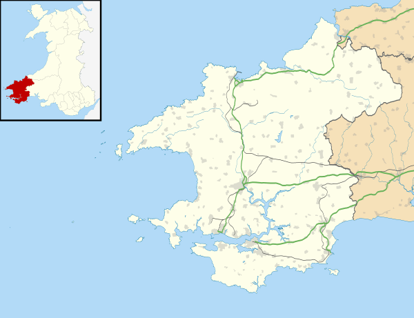
| Principal area | Pembrokeshire |
| Country | Wales |
| Sovereign state | United Kingdom |
| Post town | Clarbeston Road |
| Postcode district | SA63 |
| Dialling code | 01348 |
| Police | Dyfed-Powys |
| Fire | Mid and West Wales |
| Ambulance | Welsh |
| EU Parliament | Wales |
| UK Parliament | Preseli Pembrokeshire |
| Welsh Assembly | Preseli Pembrokeshire |
|
|
Coordinates: 51°55′01″N 4°51′04″W / 51.917°N 4.851°W
Tufton is a crossroads hamlet in the parish of Henry's Moat in Pembrokeshire, Wales, on the B4329, a road between Eglwyswrw and Haverfordwest across the Preseli Hills. It is in the community of Puncheston.
Name
The origin of the name Tufton is not clear. There is a tenuous link in the marriage of Joseph Foster-Barham of Trecwn, who inherited Pembrokeshire property from his mother[1] and whose nephew was a Pembroke JP, to Caroline Tufton, daughter of Sackville Tufton, 8th Earl of Thanet.[2]
Inn
The Tufton Arms inn stands at the crossroads. The pub holds a beer festival on the first Friday in July.[3] According to a 19th-century map, this was the only inn in the parish.[4]
Chapel
Siloh Chapel is a Calvanistic Methodist chapel in the Union of Welsh Independent churches.[5] It was founded in 1842 and restored in 1900.[6] Short biographical details of the early ministers and members of the congregation appeared in a history published in 1871.[7]
Transport
Tufton is on the B4329, a centuries-old route between Cardigan and Haverfordwest and is on a bus route. National Cycle Route 47 crosses the B4329 at Tufton.
Blaenwern
The hymn tune Blaenwern is named after a farm near Tufton where the composer, William Penfro Rowlands, was either sent as a boy, or sent his son, to recuperate from an illness in the early 20th century.[8]
Historic structures
"Tufton Castle" is the name given by Coflein to an enclosure just north of the hamlet which may have been an ancient Iron Age settlement.[9] Coflein records a mediaeval strip field system, identified from aerial reconnaissance in 2007[10] and a post-mediaeval rubble stone house worthy of note.[11]
Richard Fenton, in the early 19th century, described a small roadside house as Poll-tax Inn.[12] Fenton attributes the name to a place where poll tax was collected, but other names have been used, such as Paltockes Inne in 1200.[13] It appears on an old parish map south of Tufton on the B4329, which has now bypassed the place, in the parish of Castlebythe.[14]
References
- ↑ "The History of Parliament". Retrieved 17 May 2015.
- ↑ "Dictionary of Welsh Biography". Retrieved 16 May 2015.
- ↑ "CAMRA Pembrokeshire". Retrieved 16 May 2015.
- ↑ "GENUKI: Parish map (No.48)". Retrieved 16 May 2015.
- ↑ Lloyd, T., Orbach, J and Scourfield, R. (2004). Pembrokeshire. Yale University Press. p. 226. ISBN 9780300101782. Retrieved 17 May 2015.
- ↑ "GENUKI: Henry's Moat". Retrieved 16 May 2015.
- ↑ Rees, T. and Thomas, J. (1871). History of the Welsh Independent Churches. Retrieved 16 May 2015.
- ↑ Humphreys, M. and Evans, R. (1997). Dictionary of Composers for the Church in Great Britain and Ireland. A&C Black. p. 295. ISBN 9780720123302. Retrieved 16 May 2015.
- ↑ "Coflein: Tufton Castle". Retrieved 17 May 2015.
- ↑ "Coflein: Strip field system, Tufton". Retrieved 17 May 2015.
- ↑ "Coflein: Home Tufton". Retrieved 17 May 2015.
- ↑ Fenton, R. (1811). A Historical tour through Pembrokeshire. Longman, Hurst, Rees, Orme & Co. p. 356. Retrieved 17 May 2015.
- ↑ Smith, P. (1988). Houses of the Welsh Countryside: A Study in Historical Geography. Royal Commission on the Ancient and Historical Monuments of Wales. p. 352. ISBN 9780113000128. Retrieved 17 May 2015.
- ↑ "GENUKI: Parish map (No.49)". Retrieved 16 May 2015.