Tuqma
| Tuqma | |
|---|---|
 Tuqma Location within Bolivia | |
| Highest point | |
| Elevation | 2,800 m (9,200 ft) [1] |
| Coordinates | 17°48′03″S 65°22′45″W / 17.80083°S 65.37917°WCoordinates: 17°48′03″S 65°22′45″W / 17.80083°S 65.37917°W |
| Geography | |
| Location |
Bolivia, Cochabamba Department |
| Parent range | Andes |
Tuqma (Quechua for canine tooth,[2] also spelled Tujma) is a mountain in the Bolivian Andes which reaches a height of approximately 2,800 m (9,200 ft). It is located in the Cochabamba Department, Mizque Province, Mizque Municipality, near the border to the Carrasco Province, Pocona Municipality. Tuqma lies south of Misk'i. The Wanaku Mayu ("guanaco river") flows along its northern slope.[1][3]
References
Capital: Cochabamba | ||
| Provinces | 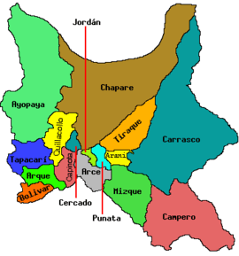 | |
| Municipalities (and seats) |
| |
This article is issued from Wikipedia - version of the 4/9/2016. The text is available under the Creative Commons Attribution/Share Alike but additional terms may apply for the media files.