Turkey River (Iowa)
| Turkey River | |
| River | |
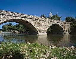 Keystone Bridge in Elkader | |
| Country | US |
|---|---|
| State | Iowa |
| Districts | Clayton County, Iowa, Fayette County, Iowa, Winneshiek County, Iowa, Howard County, Iowa |
| Tributaries | |
| - left | Roberts Creek |
| - right | Volga River, Little Turkey River |
| Source | |
| - coordinates | 43°20′31″N 92°18′40″W / 43.342°N 92.311°W |
| Mouth | Mississippi River |
| - elevation | 610 ft (186 m) |
| - coordinates | 42°43′01″N 91°00′43″W / 42.717°N 91.012°WCoordinates: 42°43′01″N 91°00′43″W / 42.717°N 91.012°W |
 Turkey River watershed | |
| U.S. Geological Survey Geographic Names Information System: Turkey River (Iowa) | |
The Turkey River is a 153-mile-long (246 km)[1] tributary of the upper Mississippi River. Its main branch rises in Howard County, Iowa, near the city of Cresco. The other counties it or its tributaries cover are Chickasaw, Winneshiek, Fayette, Clayton, Delaware, and Dubuque. Tributaries include the Little Turkey River and Crane Creek.
Flowing from northwest to southeast, it flows through or near the cities of Spillville, Fort Atkinson, Eldorado (where it joins with the Little Turkey River), Clermont, Elgin, Elkader, Elkport, Garber, and Millville, before entering the Mississippi south of Guttenberg and across from Cassville, Wisconsin.
The watershed covers 1,083,200 acres (4,384 km2).
Recreational and wildlife areas
- Cardinal Marsh Wildlife Management Area is a few miles southeast of Cresco.
- The mouth of the river is part of the Upper Mississippi River National Wildlife and Fish Refuge.
See also
References
- ↑ U.S. Geological Survey. National Hydrography Dataset high-resolution flowline data. The National Map, accessed May 13, 2011
External links
This article is issued from Wikipedia - version of the 9/11/2016. The text is available under the Creative Commons Attribution/Share Alike but additional terms may apply for the media files.