Tylöskog
Tylöskog is a deep and extensive forest between the agricultural plains of the counties of Närke and Östergötland in southeast Sweden. Together with Tiveden to its west and Kolmården to its east, it famously constituted the wartorn frontier between the Swedes in Svealand and the Geats in Götaland during the formation of the Swedish nation in the 13th century. The name is derived from Tylö, a small locality in the forest (the suffix skog meaning forest in Swedish).
External links
See also
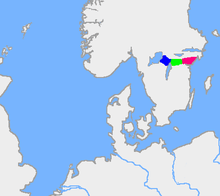
Coordinates: 58°53′47″N 15°19′04″E / 58.8963°N 15.3177°E
This article is issued from Wikipedia - version of the 11/10/2016. The text is available under the Creative Commons Attribution/Share Alike but additional terms may apply for the media files.