Vermont Route 44
| ||||
|---|---|---|---|---|
|
Map of Windsor County in eastern Vermont with VT 44 highlighted in red | ||||
| Route information | ||||
| Maintained by VTrans and Town of Windsor | ||||
| Length: | 10.188 mi[1] (16.396 km) | |||
| Major junctions | ||||
| West end: |
| |||
|
| ||||
| East end: |
| |||
| Location | ||||
| Counties: | Windsor | |||
| Highway system | ||||
| ||||


Vermont Route 44 (VT 44) is a state highway in the U.S. state of Vermont. The state highway runs 10.190 miles (16.399 km) from VT 106 in Reading east to U.S. Route 5 (US 5) and VT 12 in Windsor. VT 44 passes through West Windsor in southern Windsor County, serving the area north of Mount Ascutney. The state highway is maintained by the town of Windsor east of the highway's junction with VT 44A.[2]
Route description
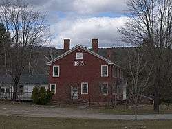
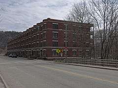
VT 44 begins at an intersection with VT 106 north of the hamlet of Felchville in the southeastern part of the town of Reading. The state highway parallels Mill Brook east into the town of West Windsor. After passing through the village of Brownsville, VT 44 passes the entrance to Ascutney Mountain Resort. The state highway enters the town of Windsor, where it passes along the northern edge of Mount Ascutney and provides access to the Brownsville hiking trail to the top of the mountain. East of its oblique junction with VT 44A (Back Mountain Road), VT 44 descends to Mill Brook, which the highway crosses just before passing under Interstate 91 with no access. The state highway curves north with Mill Brook as Ascutney Street, which the highway follows into the town center of Windsor. VT 44 passes Mill Pond before curving east onto Union Street. The state highway crosses Mill Brook twice more in the downtown area before reaching its eastern terminus at US 5 and VT 12 (Main Street) just north of the historic Robbins and Lawrence Armory and Machine Shop, home of the American Precision Museum. The roadway continues east as Bridge Street, which leads to the Cornish-Windsor Covered Bridge across the Connecticut River and into the state of New Hampshire.[3]
Major intersections
The entire route is in Windsor County. [1]
| Location[1] | mi[1] | km | Destinations | Notes | |
|---|---|---|---|---|---|
| Reading | 0.000 | 0.000 | Western terminus | ||
| Windsor | 6.853 | 11.029 | |||
| 10.188 | 16.396 | Bridge Street east | Eastern terminus | ||
| 1.000 mi = 1.609 km; 1.000 km = 0.621 mi | |||||
References
- 1 2 3 4 Traffic Research Unit (May 2013). "2012 (Route Log) AADTs for State Highways" (PDF). Policy, Planning and Intermodal Development Division, Vermont Agency of Transportation. Retrieved March 12, 2015.
- ↑ "Map Showing Functional Classification of Vermont Highways" (PDF). Vermont Agency of Transportation. June 13, 2011. Retrieved 2011-09-20.
- ↑ Google (2011-09-20). "Vermont Route 44" (Map). Google Maps. Google. Retrieved 2011-09-20.