Vakinankaratra
| Vakinankaratra Region | |
|---|---|
| Region | |
 Location in Madagascar | |
| Country |
|
| Capital | Antsirabe |
| Area | |
| • Total | 16,599 km2 (6,409 sq mi) |
| Population (2013) | |
| • Total | 1,803,307 |
| • Density | 110/km2 (280/sq mi) |
| • Ethnicities | Merina |
| Time zone | EAT (UTC3) |
Vakinankaratra is a region in central Madagascar. The capital of the region is Antsirabe. Vakinankaratra covers an area of 16,599 kilometres (10,314 miles), and had an estimated population of 1,803,307 in 2013.[1]
History
The kingdom of Vakinankaratra, known as the kingdom of the river Andrantsay, was founded at the beginning of the 17th century by Andrianony, a prince originally from Alasora, south of Antananarivo. The capital of the kingdom used to be Fivavahana in today's Betafo District.
The last ruler of the Kingdom of Andrantsay was Andriamanalinarivo who was on the throne when Imerina king Andrianampoinimerina conquered the area with the help of the young prince Radama at the beginning of the 19th century. The territory was integrated into the Merina Kingdom under the new name Vakinankaratra.
During the colonial period the centre of the region shifted to Antsirabe.
Population
Vakinankaratra is the second most populous region of Madagascar and it has the second highest population density, only beaten by Analamanga, where the national capital and biggest city, Antananarivo, is located. In 2013, Vakinankaratra had an estimated population of 1,803,307 and an average density of 108.6 people per km².[1] The vast majority of the population belongs to the Merina ethnic group.
Geography

Vakinankaratra is situated in the central highlands of Madagascar. The region covers an area of 16,599 km2 (6,409 sq mi), making it the third least extensive region in Madagascar. It borders the region of Bongolava in the northwest, Itasy in the north, Analamanga in the northeast, Alaotra Mangoro and Atsinanana in the east, Amoron'i Mania in the south, and Menabe to the west.
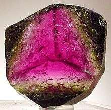
A number of precious minerals are found in Vakinankaratra, including Ferrocolumbite, Liddicoatite, and Londonite.
Administrative divisions
Vakinankaratra region is divided into seven districts, which are sub-divided into 86 communes.
- Ambatolampy District
- Antanifotsy District
- Antsirabe I District
- Antsirabe II District
- Betafo District
- Faratsiho District
- Mandoto District
Politics
Since 2009, after the beginning of the national political crisis, Paul Razanakolona has held the position of Chief of Region.[2] Previous region chiefs include Lantoniaina Nirina Harintsoa Rabenantoandro (2004-2008) and Étienne Randimbiharimanana (2008-2009).[3]
See also
References
- 1 2 Institut National de la Statistique, Antananarivo.
- ↑ Razanakolona, Paul. "Le mot du chef de région" (in French). Région Vakinankaratra. Retrieved 2012-05-01.
- ↑ Cahoon, Ben. "Madagascar Provinces and Regions". Worldstatesmen.org. Retrieved 2012-05-01.
External links
- Région Vakinankaratra Official site in French.
- Tourism Official tourism site of Vakinankaratra.
Coordinates: 19°52′05″S 47°02′02″E / 19.868°S 47.034°E