Valiyaparamba
Valiyaparamba is a small island in Kasaragod district, Kerala state, India.
Location
Valiyaparamba is located 5 kilometres (3.1 mi) south west of Cheruvathur separated from the mainland by Kavvayi Backwater and about 30 kilometres (19 mi) from Bekal, Kasaragod, north Kerala. The island is approximately 16 km2 (6 sq mi) in size with a population of 10,000. The island's main source of income come from agriculture and fishing. The Island has 13 wards ruling by each ward member to leading the Valiyaparamba Panchayathu.
Geography
Valiyaparamba is fed by four rivers and dotted with numerous little islands, Valiyaparamba is fast turning into a much favoured backwater resort that offers enchanting boat cruises. Valiyaparamba, a hinterland separated from the mainland, is a noted fishing centre in the district and is just an hour drive from Bekal - one of the most enchanting beaches of Kerala. The Bekal fort which stands on a headland that runs into the sea offers a spectacular view of the surroundings. The National Water Way passes through this beautiful Island and foreign tourist halt here for few hours on the way to Bekal in house boat.
Education
The island has 7 Primary Schools, 1 High School and 1 Higher Secondary School. The Mangrove Trail of Malabar is a day trippers visiting place about 20 km (12 mi) from Valiaparamba. It is a coastal Jungle trail offering hiking, birding & boating. visit www.malabarecotourism.com for more details.
Getting there
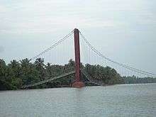
This Island is separated from the main land, You Can either use Transport Boat Service/ another Water Transportation or crossing the Mavila Kadappuram Bridge to reach in main land
- Nearest railway station: Cheruvathur, on the Kozhikode-Mangalore route, about 5 km (3 mi) from Valiyaparamba,
- National Highway (NH 17) is also passing through Cheruvthur. You will get hotel rooms at Nileshwar or Payyanur.
- Nearest airports: Mangalore in Karnataka State, about 100 km (62 mi); Karipur international airport Kozhikode, about 150 km (93 mi) from Valiyaparamba.
See also
- Payyannur
- Korom 5 km from Payyanur
- Karinkuzhi 4 km from Payyanur Municipal Center
- Peringome 20 km from Payyanur
- Ezhimala 12 km from Payyanur Town
- Kunhimangalam village 8 km from Payyanur town
- Kavvayi Island 3 km from Payyanur
- Ramanthali 7 km from Payyanur
- Karivellur 10 km from Payyanur
- Trikarpur 6 km from Payyanur
Coordinates: 12°08′40″N 75°08′40″E / 12.144443°N 75.144323°E