Salaberry-de-Valleyfield
| Salaberry-de-Valleyfield | ||
|---|---|---|
| City | ||
 | ||
| ||
| Nickname(s): Valleyfield | ||
 Location within Beauharnois-Salaberry RCM | ||
 Salaberry-de-Valleyfield Location in southern Quebec | ||
| Coordinates: 45°15′N 74°08′W / 45.25°N 74.13°WCoordinates: 45°15′N 74°08′W / 45.25°N 74.13°W[1] | ||
| Country |
| |
| Province |
| |
| Region | Montérégie | |
| RCM | Beauharnois-Salaberry | |
| Founded | 1874 | |
| Constituted | April 24, 2002 | |
| Government[2][3] | ||
| • Mayor | Denis Lapointe | |
| • Federal riding | Salaberry—Suroît | |
| • Prov. riding | Beauharnois | |
| Area[2][4] | ||
| • City | 125.50 km2 (48.46 sq mi) | |
| • Land | 107.10 km2 (41.35 sq mi) | |
| • Metro[5] | 107.10 km2 (41.35 sq mi) | |
| Population (2011)[4] | ||
| • City | 40,077 | |
| • Density | 374.2/km2 (969/sq mi) | |
| • Metro[5] | 40,077 | |
| • Metro density | 374.2/km2 (969/sq mi) | |
| • Pop 2006-2011 |
| |
| • Dwellings | 19,050 | |
| Time zone | EST (UTC−5) | |
| • Summer (DST) | EDT (UTC−4) | |
| Postal code(s) | J6S, J6T | |
| Area code(s) | 450 and 579 | |
| Highways |
| |
| Website |
www | |
.svg.png)
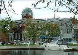
Salaberry-de-Valleyfield is a city in southwestern Quebec, Canada, in the Regional County Municipality of Beauharnois-Salaberry. The population as of the Canada 2011 Census was 40,077. Situated on an island in the Saint Lawrence River, it is bordered at its western end by Lake Saint Francis, with the Saint Lawrence to the north and the Beauharnois Canal to its south. The Port of Valleyfield is situated on the canal.
History
Salaberry was named after Colonel Charles de Salaberry who served with the British army during the War of 1812. "Valleyfield" came from the Valleyfield Mills, a paper mill south of Edinburgh in Scotland.
It is the seat of the Roman Catholic Diocese of Valleyfield.
Salaberry-de-Valleyfield is the seat of the judicial district of Beauharnois.[6]
Merger
In 2002, the city of 26,170 amalgamated with the following communities[7] (2001 Canada census figures):
- Saint-Timothée (8,299)
- Grande-Île (4,559)
Climate
| Climate data for Salaberry-de-Valleyfield | |||||||||||||
|---|---|---|---|---|---|---|---|---|---|---|---|---|---|
| Month | Jan | Feb | Mar | Apr | May | Jun | Jul | Aug | Sep | Oct | Nov | Dec | Year |
| Record high °C (°F) | 14.0 (57.2) |
16.0 (60.8) |
23.0 (73.4) |
30.0 (86) |
35.0 (95) |
34.4 (93.9) |
35.6 (96.1) |
36.5 (97.7) |
35.0 (95) |
28.9 (84) |
22.5 (72.5) |
17.0 (62.6) |
36.5 (97.7) |
| Average high °C (°F) | −5.4 (22.3) |
−3.3 (26.1) |
2.3 (36.1) |
11.2 (52.2) |
18.7 (65.7) |
23.8 (74.8) |
26.1 (79) |
25.3 (77.5) |
20.6 (69.1) |
12.8 (55) |
5.8 (42.4) |
−1.4 (29.5) |
11.4 (52.5) |
| Daily mean °C (°F) | −9.6 (14.7) |
−7.8 (18) |
−2.2 (28) |
6.3 (43.3) |
13.3 (55.9) |
18.7 (65.7) |
21.1 (70) |
20.2 (68.4) |
15.6 (60.1) |
8.6 (47.5) |
2.2 (36) |
−5.1 (22.8) |
6.8 (44.2) |
| Average low °C (°F) | −13.8 (7.2) |
−12.3 (9.9) |
−6.7 (19.9) |
1.3 (34.3) |
7.9 (46.2) |
13.5 (56.3) |
16.0 (60.8) |
15.1 (59.2) |
10.6 (51.1) |
4.3 (39.7) |
−1.4 (29.5) |
−8.8 (16.2) |
2.1 (35.8) |
| Record low °C (°F) | −38.3 (−36.9) |
−33.5 (−28.3) |
−29 (−20) |
−15.6 (3.9) |
−4.4 (24.1) |
2.2 (36) |
6.5 (43.7) |
1.7 (35.1) |
−2.0 (28.4) |
−8.9 (16) |
−21.0 (−5.8) |
−32.0 (−25.6) |
−38.3 (−36.9) |
| Average precipitation mm (inches) | 74.8 (2.945) |
59.3 (2.335) |
61.9 (2.437) |
77.3 (3.043) |
82.9 (3.264) |
94.7 (3.728) |
97.6 (3.843) |
92.5 (3.642) |
82.6 (3.252) |
92.0 (3.622) |
85.7 (3.374) |
76.8 (3.024) |
978.0 (38.504) |
| Average rainfall mm (inches) | 24.2 (0.953) |
19.9 (0.783) |
31.9 (1.256) |
70.3 (2.768) |
82.9 (3.264) |
97.4 (3.835) |
97.6 (3.843) |
92.5 (3.642) |
82.6 (3.252) |
90.6 (3.567) |
74.4 (2.929) |
33.1 (1.303) |
794.7 (31.287) |
| Average snowfall cm (inches) | 50.6 (19.92) |
39.3 (15.47) |
30.1 (11.85) |
7.2 (2.83) |
0.0 (0) |
0.0 (0) |
0.0 (0) |
0.0 (0) |
0.0 (0) |
1.3 (0.51) |
11.3 (4.45) |
43.7 (17.2) |
183.5 (72.24) |
| Source: Environment Canada[8] | |||||||||||||
Demographics
Population
| Canada census – Salaberry-de-Valleyfield community profile | |||
|---|---|---|---|
| 2011 | 2006 | 2001 | |
| Population: | 40,077 (+1.0% from 2006) | 39,672 (+51.6% from 2001) | 26,170 (-1.6% from 1996) |
| Land area: | 107.10 km2 (41.35 sq mi) | 107.10 km2 (41.35 sq mi) | 27.45 km2 (10.60 sq mi) |
| Population density: | 374.2/km2 (969/sq mi) | 370.4/km2 (959/sq mi) | 953.5/km2 (2,470/sq mi) |
| Median age: | 47.1 (M: 45.1, F: 48.7) | 44.6 (M: 42.9, F: 46.2) | 43.2 (M: 40.9, F: 45.5) |
| Total private dwellings: | 19,050 | 18,034 | 12,350 |
| Median household income: | $44,510 | $41,880 | $32,812 |
| Notes: Amalgamated with Saint-Timothée and Grande-Île in 2002. – References: 2011[9] 2006[10] 2001[11] | |||
| Historical Census Data - Salaberry-de-Valleyfield, Quebec[12] | ||
|---|---|---|
| Year | Pop. | ±% |
| 1991 | 27,598 | — |
| 1996 | 26,600 | −3.6% |
| 2001 | 26,170 | −1.6% |
| 2006 | 39,672 | +51.6% |
| 2011 | 40,077 | +1.0% |
Amalgamated with Saint-Timothée and Grande-Île in 2002. | ||
Language
| Canada Census Mother Tongue - Salaberry-de-Valleyfield, Quebec[12] Amalgamated with Saint-Timothée and Grande-Île in 2002. | ||||||||||||||||||
|---|---|---|---|---|---|---|---|---|---|---|---|---|---|---|---|---|---|---|
| Census | Total | French |
English |
French & English |
Other | |||||||||||||
| Year | Responses | Count | Trend | Pop % | Count | Trend | Pop % | Count | Trend | Pop % | Count | Trend | Pop % | |||||
| 2011 |
39,425 |
37,475 | |
95.05% | 1,105 | |
2.80% | 455 | |
1.15% | 390 | |
0.99% | |||||
| 2006 |
38,565 |
36,845 | |
95.54% | 1,035 | |
2.68% | 240 | |
0.62% | 445 | |
1.15% | |||||
| 2001 |
25,450 |
24,260 | |
95.32% | 735 | |
2.89% | 200 | |
0.79% | 255 | |
1.00% | |||||
| 1996 |
25,995 |
24,855 | n/a | 95.61% | 660 | n/a | 2.54% | 235 | n/a | 0.90% | 245 | n/a | 0.94% | |||||
Attractions
The Écomusée des Deux-Rives, which covers the economic and cultural history of the region, is found in the city.
The city has been the site of the Valleyfield Regatas since 1938. The event takes place every year at the beginning of July over a three day period in the heart of the city on Bay Saint-Francois. The Regata is an international hydroplane boat race, where the hydroplanes (planes without wings) can achieve speeds of up to 225 km/h. Attracting over 130,000 visitors per year, it is a great weekend of thrilling hydroplane races, dinners, parties, outdoor concerts featuring renowned Quebec artists. It is capped off by a fireworks show.[13]
Education
- 9 daycare facilities
- 3 pre-kindergarten centres
- 12 elementary schools (some with daycare services)
- 1 English-language elementary school
- 2 high schools
- 1 adult education centre
- 2 vocational training centres
- 1 CEGEP: Collège de Valleyfield
Gault Institute
Gault Institute was created by a man named Andrew Frederick Gault. He created this school during the time that the Gault Cotton Mills were up and running. To heat the school at one time he used underground pipes connecting from the school to the Cotton Mills since at the time there was no electricity.
Famous natives
- Armand Frappier, physician and microbiologist
- J. Albert Leduc "Battleship" (1902-1990) protégé of Jack Laviolette, played hockey as a defenceman in the National Hockey League from 1925 to 1935. During that time he won two Stanley Cups in 1930, and 1931 for the Montreal Canadiens. In the 1950, he owned the local Arena and saw his good friend Hector Toe Blake manage the Valleyfield Braves to win the Alexander Cup, awarded to the Canadian Major Senior Hockey Champions. He also owned Les industries Bellerive, a wood mill known to manufacture the "Battleship" hockey sticks and church benches. He was also Valleyfield's first Molson agent.
- Jean Ouimet, politician
- Pierre Cossette (December 15, 1923 – September 11, 2009)[1][2] was a television executive producer and Broadway producer who brought the Grammy Awards to television. Cossette was inducted into Canada's Walk of Fame in 2005. Born in Valleyfield, Quebec, he also has a star on the Hollywood Walk of Fame.
- Jean-Luc Brassard (August 24, 1972) freestyle skier, winning the gold medal at the 1994 Winter Olympics in the sport's debut as a medal event. Brassard has been credited with popularizing the wearing of bright knee pads to show off absorption and leg position for mogul skiers to best show judges how smoothly the athlete is taking the turns. Brassard placed 7th when the event was a demonstration sport in 1992, 4th in 1998 and 21st in 2002.
- Mélodie Daoust, member of Canada's women's ice hockey team that won gold at the 2014 Sochi Winter Olympics.
- Anne Minh-Thu Quach, current MP for the electoral district of Beauharnois—Salaberry.
See also
References
- ↑ Reference number 125037 of the Commission de toponymie du Québec (French)
- 1 2 Affaires Municipales et Regions Quebec: Salaberry-de-Valleyfield
- ↑ Riding history for Beauharnois—Salaberry, Quebec from the Library of Parliament
- 1 2 2011 Statistics Canada Census Profile: Salaberry-de-Valleyfield, Quebec
- 1 2 2011 Statistics Canada Census Profile: Salaberry-de-Valleyfield (Census agglomeration), Quebec. The census agglomeration consists of only Salaberry-de-Valleyfield itself. This was unchanged from the 2006 census.
- ↑ Territorial Division Act. Revised Statutes of Quebec D-11.
- ↑ http://www.stat.gouv.qc.ca/publications/referenc/pdf/modavr02.pdf
- ↑ "Salaberry-de-Valleyfield Climate". Canadian Climate Normals 1981–2010 (in English and French). Environment Canada. Retrieved June 6, 2015.
- ↑ "2011 Community Profiles". Canada 2011 Census. Statistics Canada. July 5, 2013. Retrieved 2014-01-28.
- ↑ "2006 Community Profiles". Canada 2006 Census. Statistics Canada. March 30, 2011. Retrieved 2013-05-17.
- ↑ "2001 Community Profiles". Canada 2001 Census. Statistics Canada. February 17, 2012. Retrieved 2013-05-17.
- 1 2 Statistics Canada: 1996, 2001, 2006, 2011 census
- ↑ Home - Régates de Valleyfield
External links
| Wikimedia Commons has media related to Salaberry-de-Valleyfield. |
- Salaberry-de-Valleyfield official website
- Port of Valleyfield
- Photograph of the Salaberry-de-Valleyfield Basilica
 |
Coteau-du-Lac Saint Lawrence River |
Les Cèdres Saint Lawrence River |
Pointe-des-Cascades Saint Lawrence River |
|
| |
Beauharnois | |||
| ||||
| | ||||
| Beauharnois Canal Saint-Stanislas-de-Kostka |
Beauharnois Canal Saint-Louis-de-Gonzague |
| Cities | |
|---|---|
| Municipalities | |
| Parish Municipalities | |
| |