Vanoise massif
| Vanoise Massif | |
|---|---|
| French: Massif de la Vanoise | |
 The south-west side of the Grande Casse | |
| Highest point | |
| Peak | Grande Casse |
| Elevation | 3,855 m (12,648 ft) |
| Coordinates | 45°24′19″N 6°49′39″E / 45.40528°N 6.82750°ECoordinates: 45°24′19″N 6°49′39″E / 45.40528°N 6.82750°E |
| Geography | |
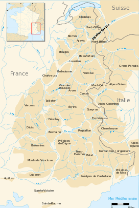 Map with subvisions of the French Alps | |
| Country | France |
| Department | Savoie |
The Vanoise massif is an important mountain range of the Graian Alps in the Western Alps. After the Mont Blanc Massif and the Massif des Écrins it is the third highest massif in France, reaching a height of 3,885m at the summit of Grande Casse. It lies between Tarentaise Valley to the north and the Maurienne valley in the south. The range is the site of France's first National Park in 1963, the Vanoise National Park. The ski resorts of Tignes and Val-d'Isère and the 2,770m high Col de l'Iseran are located in the eastern part of the range.[1]
Principal summits
The principal summits of the Vanoise massif are:
Principal glaciers
- Glaciers de la Gurraz
- Glacier de la Savinaz
- Glacier de la Grande Motte
- Glacier de Prémou
- Glacier des Volnets
- Glacier de la Grande Casse
- Glacier de la Leisse
- Glacier des Fours
- Glacier de Méan Martin
- Glacier du Vallonnet
- Glaciers de la Vanoise (Glacier du Pelve, Glacier de l'Arpont, Glacier de la Mahure)
- Glacier de Gébroulaz
- Glacier de Thorens
- Glacier du Bouchet
- Glacier de Chavière
- Glacier de Polset
- Glacier du Geay
References
- ↑ "Vanoise - summitpost". summitpost.org. Retrieved 27 January 2015.
External links
This article is issued from Wikipedia - version of the 11/28/2016. The text is available under the Creative Commons Attribution/Share Alike but additional terms may apply for the media files.