Vassall (ward)
Vassall ward is an administrative division of the London Borough of Lambeth, United Kingdom. It is located in the North of borough bordering Southwark, in the SW9 and SE5 postcode area. The area is named for Henry Vassall-Fox, 3rd Baron Holland who was responsible for the first building development in the area in the 1820s.
The ward includes parts of Kennington, Oval, Brixton, Stockwell and Camberwell. The ward is noted for its high numbers of households living in deprived conditions. Housing stock in the ward ranges from large detached houses to towerblocks - ONS figures show that over 61% of housing in the ward is rented from the local authority or from a housing association with many people living on large housing estates such as the Myatts Fields North, Myatts Fields South, Cowley, Holland Town and Caldwell Gardens estate.


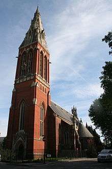
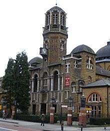
The ward contains several open spaces and parks including Myatt's Fields Park, Mostyn Gardens and Slade Gardens. It also contains the churches of St John the Divine, Kennington and Christ Church Brixton Road. At the 2011 Census the population of the ward was 14,143.[1]
Vassall ward is located in the Vauxhall parliamentary constituency and is one of four wards in the borough's north Lambeth division.
Lambeth Council elections 2010
At the Lambeth Council elections, 2010 residents of Vassall ward elected three Labour Party councillors, Jacqui Dyer, Paul Gadsby and Annie Gallop. Previous Vassall ward councillors include Dan Sabbagh and Kitty Ussher.
Former residents of Vassall ward
Artist Vincent van Gogh briefly lived in Hackford Road in Vassall ward. Other famous former Vassall inhabitants include Prime Minister John Major who lived in Burton Road, music hall artist Dan Leno and landscape painter David Cox.
References
- ↑ "Lambeth Ward population 2011". Neighbourhood Statistics. Office for National Statistics. Retrieved 12 October 2016.
External links
- Lambeth Borough Council profile for the ward
- Lambeth map of the ward
- Vassall ward election results on lambeth website
- Vassall View Vassall Ward website with local news and information and details of Vassall Labour Party
- Vassall and Oval ward map and information from 1918
Coordinates: 51°28′30″N 0°06′32″W / 51.475°N 0.109°W