Vermont Route 122
| ||||
|---|---|---|---|---|
|
Map of northeastern Vermont with VT 122 highlighted in red | ||||
| Route information | ||||
| Maintained by VTrans | ||||
| Length: | 15.215 mi[1] (24.486 km) | |||
| Major junctions | ||||
| South end: |
| |||
|
| ||||
| North end: |
| |||
| Location | ||||
| Counties: | Caledonia, Orleans | |||
| Highway system | ||||
| ||||

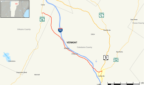
Vermont Route 122 (VT 122) is a 15.215-mile-long (24.486 km) north–south state highway in northeastern Vermont. The southern terminus of the route is at the intersection with U.S. Route 5 and the southern terminus of Vermont Route 114 in the town of Lyndon, Caledonia County. Its northern terminus is at the intersection with Vermont Route 16 in the town of Glover, Orleans County.
Major intersections
| County | Location[1] | mi[1] | km | Destinations | Notes |
|---|---|---|---|---|---|
| Caledonia | Lyndon | 0.000 | 0.000 | Southern terminus; southern terminus of VT 114 | |
| 0.563 | 0.906 | ||||
| 1.733– 2.059 | 2.789– 3.314 | Exit 24 on I-91 | |||
| Orleans | Glover | 15.215 | 24.486 | Northern terminus | |
| 1.000 mi = 1.609 km; 1.000 km = 0.621 mi | |||||
References
- 1 2 3 Traffic Research Unit (May 2013). "2012 (Route Log) AADTs for State Highways" (PDF). Policy, Planning and Intermodal Development Division, Vermont Agency of Transportation. Retrieved April 22, 2015.
External links
This article is issued from Wikipedia - version of the 7/27/2015. The text is available under the Creative Commons Attribution/Share Alike but additional terms may apply for the media files.