Vesela Gora
| Vesela Gora | |
|---|---|
 | |
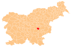
 Vesela Gora Location in Slovenia | |
| Coordinates: 45°58′12.34″N 15°4′46.6″E / 45.9700944°N 15.079611°ECoordinates: 45°58′12.34″N 15°4′46.6″E / 45.9700944°N 15.079611°E | |
| Country |
|
| Traditional region | Lower Carniola |
| Statistical region | Southeast Slovenia |
| Municipality | Šentrupert |
| Area | |
| • Total | 0.32 km2 (0.12 sq mi) |
| Elevation | 310.6 m (1,019.0 ft) |
| Population (2002) | |
| • Total | 46 |
| [1] | |
Vesela Gora (pronounced [ʋɛˈseːla ˈɡɔːɾa]) is a small settlement in the Municipality of Šentrupert in southeastern Slovenia. The area is part of the historical region of Lower Carniola. The municipality is now included in the Southeast Slovenia Statistical Region.[2]
History
Vesela Gora was established in 1992, when its territory was separated from Brinje and it was made a settlement in its own right.[3]
Church
The pilgrimage church in the settlement is dedicated to Saint Francis Xavier and belongs to the Parish of Šentrupert. It was built from 1723 to 1735 and has two belfries.[4]
References
- ↑ Statistical Office of the Republic of Slovenia Archived November 18, 2008, at the Wayback Machine.
- ↑ Šentrupert municipal site Archived May 25, 2012, at the Wayback Machine.
- ↑ Statistical Office of the Republic of Slovenia: Vesela Gora
- ↑ "EŠD 810". Registry of Immovable Cultural Heritage (in Slovenian). Ministry of Culture of the Republic of Slovenia. Retrieved 20 July 2011.
External links
 Media related to Vesela Gora at Wikimedia Commons
- Vesela Gora at Geopedia
| Settlements | Administrative centre: Šentrupert
|  |
|---|---|---|
| Landmarks |
| |
| Notable people |
| |
This article is issued from Wikipedia - version of the 11/15/2016. The text is available under the Creative Commons Attribution/Share Alike but additional terms may apply for the media files.