Villarrubia de los Ojos
| Villarrubia de los Ojos | ||
|---|---|---|
| Municipality | ||
|
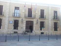
City hall | ||
| ||
 Villarrubia de los Ojos Location in Spain | ||
| Coordinates: 39°13′N 3°36′W / 39.217°N 3.600°WCoordinates: 39°13′N 3°36′W / 39.217°N 3.600°W | ||
| Country |
| |
| Autonomous community |
| |
| Province | Ciudad Real | |
| Comarca | Campo de Calatrava | |
| Area | ||
| • Total | 281.86 km2 (108.83 sq mi) | |
| Elevation | 624 m (2,047 ft) | |
| Population (2010) | ||
| • Total | 11,119 | |
| • Density | 39/km2 (100/sq mi) | |
| Demonym(s) | Villarrubiero, Villarrubiera | |
| Time zone | CET (UTC+1) | |
| • Summer (DST) | CEST (UTC+2) | |
| Postal code | 13670 | |

Villarrubia de los Ojos is a municipality in Ciudad Real, Castile-La Mancha, Spain. According to the 2010 census[1] the municipality has a population of 11,119 inhabitants.
The Ojos del Guadiana are located within the Villarrubia de los Ojos municipal term.[2] They are the source of the Guadiana river, the fourth longest river of the Iberian peninsula. There's also a National Park, the Tablas de Daimiel National Park located in the Tablas de Daimiel wetlands, shared with the neighbouring municipality, Daimiel.
Geography
The landforms of Villarrubia de los Ojos are mountaineus in the north and flat in the south. The weather is quite strong with very cold winters and very hot summers. There are some mountains over 1.200 metres and the flat zone is at 550 metres above sea level in the Spanish central plateau.
References
Bibliography
- DADSON, Trevor J. (2004) "Literacy and Education in Early Modern Rural Spain: the case of Villarrubia de los Ojos" Bulletin of Spanish Studies: Hispanic Studies and Research on Spain, Portugal and Latin America, ISSN 1475-3820, Vol. 81, Nº 7-8, 2004, pags. 1011-1038.
- DADSON, Trevor J. (2007) "Un Ricote verdadero: el licenciado Alonso Herrador de Villarrubia de los Ojos del Guadiana - morisco que vuelve." Memoria de la palabra : Actas del VI Congreso de la Asociación Internacional Siglo de Oro, Burgos-La Rioja 15-19 de julio 2002 / coord. por Francisco Domínguez Matito, María Luisa Lobato, Vol. 1, 2004, ISBN 978-84-8489-093-5, pags. 601-612.
- DADSON, Trevor J. (2007) Los moriscos de Villarrubia de los Ojos (siglos XV-XVIII). Historia de una minoría asimilada, expulsada y reintegrada. Iberoamericana Vervuert, 1328 pp. ISBN 978-84-8489-235-9
- DADSON, Trevor J. (2014) Tolerance and Coexistence in Early Modern Spain: Old Christians and Moriscos in the Campo de Calatrava. Rochester, NY: Tamesis. ISBN 978-1-85566-273-5.
- JEREZ GARCÍA, Óscar (2009) "Villarrubia de los Ojos de Guadiana. Geografía, Paisaje y Medio Ambiente". CERSA, Madrid, 520 pp + CD. ISBN 978-84-92539-30-7.
External links
| Wikimedia Commons has media related to Villarrubia de los Ojos. |
- Villarrubia de los Ojos In Spanish Wikipedia
- Web of the City Hall of Villarrubia de los Ojos
- Private web of Villarrubia de los Ojos
- About Trevor John Dadson and Villarrubia de los Ojos