Vippetangen
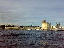
Vippetangen is the southern point of the peninsula Akersneset in central Oslo, Norway, located southeast of Akershus Fortress. It is surrounded by the Oslo Fjord and has served as an important section of the port in Oslo. The area is undergoing urban renewal and will become part of the Fjord City.
The name
The first element is vippe (a short form for vippefyr), the last element is the finite form of tange m 'pointy headland'. The name derives from a simple lighthouse that used to be located there.
History
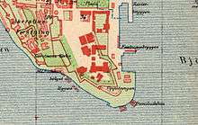
The place has been a military facility, stone quarry, as well as military and civilian bath. In the 1880s and 1890s there was ice skating on the fjord, including the first national championships. The modern construction of docks started in 1899, and on 25 November 1905 was the landing place for King Haakon VII and his family when they arrived from Denmark on the Norwegian warship Heimdal to assume the Norwegian throne.[1][2] The port facilities included fishing facilities and docks for the international passenger ships, and a grain silo. Until the 1960 grain was transport by tram via the Vippetangen Line to Nedre Foss Mill at Grünerløkka. The tram line had been built to Vippetangen by Kristiania Kommunale Sporveie in 1900, and the tram line remained in service until 1961. The railway Oslo Port Line ran through the area.
Fjord City development

Vippetangen has always been an important transport hub, and remains the main port for passenger ferries in Oslo. This includes the Copenhagen ferry route operated by Stena Line and DFDS, and the water bus routes operated by Ruter to the Oslo Islands[3]—these will remain after the development of the Fjord City as one of two ferry terminals in Oslo.[4] As part of the Fjord City project Ruter is planning to build a new tram line to Vippetangen, following the peninsula around from Aker Brygge to Bjørvika.[5]
References
- ↑ Sogn og Fjordane county archives: 1905 - the new king and royal family (Norwegian)
- ↑ Oslo Port Authority. "Lysfestival på Vippetangen" (in Norwegian). Retrieved 2008-08-20.
- ↑ Ruter. "Båt" (in Norwegian). Archived from the original on 2008-04-28. Retrieved 2008-08-16.
- ↑ Oslo Teknopol. "Vippetangen". Retrieved 2008-08-16.
- ↑ Oslo Waterfront Planning Office (2006-11-16). "Tilgjengelighet i Fjordbyen Del 3 Prinsipper for transportsystemet" (PDF). p. 87.
Coordinates: 59°54′10.386″N 10°44′30.700″E / 59.90288500°N 10.74186111°E