Waimea Valley
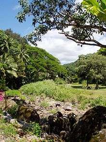
Waimea Valley is an area of historic cultural significance on the North Shore of Oahu, Hawaii. The valley, being an important place in Hawaiian religion, includes several historical structures including stone terraces and walls constructed during the time of the Hawaiian monarchy. Much of the garden floor was once cultivated for taro, sweet potato, and bananas, with new crops and orchards introduced by Europeans after their arrival.
Historical nature park
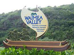
Formerly known as the Waimea Valley Audubon Center and the Waimea Arboretum and Botanical Garden, the Waimea Valley is a historical nature park including botanical gardens. It is located at 59-864 Kamehameha Highway, Haleiwa, Oahu, Hawaii and is open daily except for Christmas and New Year's Day; an admission fee is charged.
The garden was managed until 2003 by the City and County of Honolulu, when management was assumed by the National Audubon Society. In 2008, management was handed over to Hi'ipaka LLC, a non-profit company created by the Office of Hawaiian Affairs.
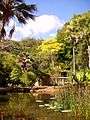
The garden now contains 35 distinct collections, representing some 5,000 taxa from around the world.[1] It contains one of the finest collections of Polynesian plants in existence, as well as excellent collections of very rare Hawaiian plants, rare and endangered species native to Lord Howe Island, and individual gardens dedicated to plants from Guam, Madagascar, the Mascarene Islands, the Ogasawara Islands, and the Seychelles.
Other major collections include the hibiscus evolutionary garden, araceae, bauhinia, bromeliaceae, heliconia, liliaceae, as well as bamboo, begonia, ferns, tropical fruit, etc.
The garden valley is approximate 0.75 miles in length, with a small waterfall and swimming hole at the valley's high end.
Activities
The Falls have been used for cliff diving featuring hourly exhibition. Swimming is allowed when divers are not performing. Additionally, Hula performances were done several times daily. [2] [3]
Images
 Waimea Valley historical nature park
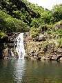 Waimea Valley historical nature park
See also
References
- ↑ Hill, Tiffany; Jessica Hamamoto (2008-04-21). "Waimea Valley reopens". Ka Leo O Hawaii. University of Hawaii Board of Publications. Archived from the original on 2011-08-05. Retrieved 2008-07-23.
- ↑ Birnbaum, Stephen. Hawaii 1983. p. 170.
- ↑ Fodor's 1989 Hawaii. p. 128.
External links
Coordinates: 21°38′02″N 158°03′06″W / 21.63389°N 158.05167°W